
IMAGES TAKEN NEAR TO
Ridge Nether Moor, SWINDON, SN3 6NE
Introduction
This page details the photographs taken nearby to Ridge Nether Moor, SN3 6NE by members of the Geograph project.
The Geograph project started in 2005 with the aim of publishing, organising and preserving representative images for every square kilometre of Great Britain, Ireland and the Isle of Man.

There are currently over 7.5m images from over14,400 individuals and you can help contribute to the project by visiting https://www.geograph.org.uk
Image Map
Images are licensed for reuse under creativecommons.org/licenses/by-sa/2.0
Notes
- Clicking on the map will re-center to the selected point.
- The higher the marker number, the further away the image location is from the centre of the postcode.
Image Listing (47 Images Found)
Images are licensed for reuse under creativecommons.org/licenses/by-sa/2.0
Image
Details
Distance
2
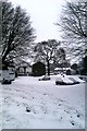
Rooks, trees and snow, Tryon Close, Liden, Swindon
A small flock of rooks is perched in an oak tree while a few other corvids sit on the roof of a nearby house possibly taking advantage of a little heat coming up through the tiles.
Image: © Brian Robert Marshall
Taken: 18 Jan 2013
0.06 miles
3
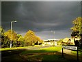
Clouds over east Swindon
Plus a few seagulls. In the event the threatened deluge failed to materialise and the clouds retained their integrity.
Image: © Brian Robert Marshall
Taken: 16 Oct 2010
0.06 miles
4
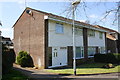
Semi-detached houses on Liden Drive
There is an OS benchmark Image on the near corner of the house, on the blank face
Image: © Roger Templeman
Taken: 22 Apr 2015
0.07 miles
5
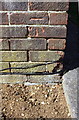
Benchmark on #52 Liden Drive
Ordnance Survey cut mark benchmark described on the Bench Mark Database at http://www.bench-marks.org.uk/bm66424
Image: © Roger Templeman
Taken: 22 Apr 2015
0.07 miles
6
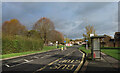
White Edge Moor Bus Stop
Along Liden Drive, the main road in this area. White Edge Moor is the name of the street just behind me in a neighbourhood where all the roads are called "something" Moor.
Image: © Des Blenkinsopp
Taken: 9 Nov 2022
0.08 miles
8
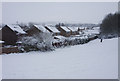
Hollinsmoor in the snow, Swindon
A heavy overnight snowfall has brought out a few youngsters to play around in the white stuff.
Image: © Brian Robert Marshall
Taken: 6 Jan 2010
0.12 miles
9
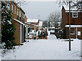
Tansley Moor near Wick Lane, Liden, Swindon
The houses here are in Tansley Moor, part of the South Dorcan Extension, developed in the 1970s and 80s.
Image: © Brian Robert Marshall
Taken: 5 Feb 2009
0.12 miles
10
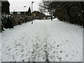
Wick Lane, Liden, Swindon (2)
Until the late 1960s Wick Lane was a minor road between the Marlborough Road and Ermin Street (or Ermin Way). At that time the area was taken over by Swindon Borough Council for the next phase in its expansion called the South Dorcan Extension. the extension was developed over the following 15 years or so. At the same time Wick Lane became redundant as a highway with the building of the A419 dual carriageway and is now a footpath and cycleway through housing on the eastern side of the developed area. This is a view looking south.
Image: © Brian Robert Marshall
Taken: 5 Feb 2009
0.14 miles