
IMAGES TAKEN NEAR TO
Heronscroft, SWINDON, SN3 5AW
Introduction
This page details the photographs taken nearby to Heronscroft, SN3 5AW by members of the Geograph project.
The Geograph project started in 2005 with the aim of publishing, organising and preserving representative images for every square kilometre of Great Britain, Ireland and the Isle of Man.

There are currently over 7.5m images from over14,400 individuals and you can help contribute to the project by visiting https://www.geograph.org.uk
Image Map
Images are licensed for reuse under creativecommons.org/licenses/by-sa/2.0
Notes
- Clicking on the map will re-center to the selected point.
- The higher the marker number, the further away the image location is from the centre of the postcode.
Image Listing (21 Images Found)
Images are licensed for reuse under creativecommons.org/licenses/by-sa/2.0
Image
Details
Distance
1
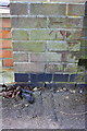
Benchmark on Merlin Way wall
Ordnance Survey cut mark benchmark described on the Bench Mark Database at http://www.bench-marks.org.uk/bm56155
Image: © Roger Templeman
Taken: 9 Apr 2015
0.02 miles
2
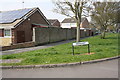
Junction of Merlin Way and Heronscroft
There is an OS benchmark Image on the near end of the brick wall
Image: © Roger Templeman
Taken: 9 Apr 2015
0.02 miles
3
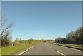
A419 northbound
Travelling northbound on the A419. There is the start of the slip road leading to Merlin Way and the A420.
Image: © Oscar Taylor
Taken: 7 Apr 2023
0.12 miles
6
The Old Road to Nythe Farm
....and site of a Roman Settlement
Image: © Colin Bates
Taken: 24 Dec 2005
0.17 miles
8
Northbound A419
The slip road to the A420 leaves on the left.
Image: © Robin Webster
Taken: 9 Jan 2022
0.18 miles
9
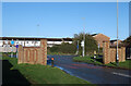
Walls at the end of the road
Where Kingfisher Drive meets Merlin Way.
These two brick gateposts with no gates would seem to be just ornamental.
I guess they're the suburban equivalent of those white 5-bar gates you get on the way into villages.
Image: © Des Blenkinsopp
Taken: 9 Nov 2022
0.19 miles
10
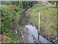
River Cole in Stratton, Swindon
Viewed looking upstream from the Merlin Way road bridge, the pole with the graduations on it is a water level gauge board, showing the height in metres above sea level. The houses to the right are in Deva Close.
Image: © Nigel Cox
Taken: 12 Oct 2007
0.20 miles