
IMAGES TAKEN NEAR TO
Hawkswood, SWINDON, SN3 5AH
Introduction
This page details the photographs taken nearby to Hawkswood, SN3 5AH by members of the Geograph project.
The Geograph project started in 2005 with the aim of publishing, organising and preserving representative images for every square kilometre of Great Britain, Ireland and the Isle of Man.

There are currently over 7.5m images from over14,400 individuals and you can help contribute to the project by visiting https://www.geograph.org.uk
Image Map
Images are licensed for reuse under creativecommons.org/licenses/by-sa/2.0
Notes
- Clicking on the map will re-center to the selected point.
- The higher the marker number, the further away the image location is from the centre of the postcode.
Image Listing (12 Images Found)
Images are licensed for reuse under creativecommons.org/licenses/by-sa/2.0
Image
Details
Distance
1
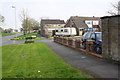
Junction of Covingham Drive and Hawkswood
There is an OS benchmark Image on the wall pier at the right hand side of the image
Image: © Roger Templeman
Taken: 9 Apr 2015
0.06 miles
2
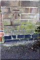
Benchmark on #2 Hawkswood garage
Ordnance Survey cut mark benchmark described on the Bench Mark Database at http://www.bench-marks.org.uk/bm56150
Image: © Roger Templeman
Taken: 9 Apr 2015
0.07 miles
4
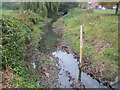
River Cole in Stratton, Swindon
Viewed looking upstream from the Merlin Way road bridge, the pole with the graduations on it is a water level gauge board, showing the height in metres above sea level. The houses to the right are in Deva Close.
Image: © Nigel Cox
Taken: 12 Oct 2007
0.13 miles
5
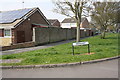
Junction of Merlin Way and Heronscroft
There is an OS benchmark Image on the near end of the brick wall
Image: © Roger Templeman
Taken: 9 Apr 2015
0.16 miles
6
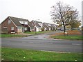
Swindon: Falconscroft, Covingham
The committee entrusted with the task of naming the roads in this large 1960s housing estate obviously sought the solution to the problem in their "Observer's Book of British Birds"! Finchdale, Heronscroft, Wrenwood, all the slightly less common ones are there, even Pipitdene. However sparrows, blackbirds and starlings all got the cold shoulder apparently. This one's Falconscroft off Covingham Drive.
Image: © Nigel Cox
Taken: 12 Oct 2007
0.16 miles
7
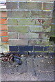
Benchmark on Merlin Way wall
Ordnance Survey cut mark benchmark described on the Bench Mark Database at http://www.bench-marks.org.uk/bm56155
Image: © Roger Templeman
Taken: 9 Apr 2015
0.17 miles
8
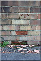
Benchmark on #1 Larksfield wall
Ordnance Survey cut mark benchmark described on the Bench Mark Database at http://www.bench-marks.org.uk/bm56149
Image: © Roger Templeman
Taken: 9 Apr 2015
0.19 miles
9
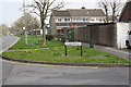
Junction of Covingham Drive and Larksfield
There is an OS benchmark Image on the wall right of the road name sign
Image: © Roger Templeman
Taken: 9 Apr 2015
0.19 miles
10
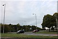
Roundabout on Merlin Way entering Swindon
Image: © David Howard
Taken: 9 Sep 2018
0.25 miles