
IMAGES TAKEN NEAR TO
Charfield Close, SWINDON, SN3 2JD
Introduction
This page details the photographs taken nearby to Charfield Close, SN3 2JD by members of the Geograph project.
The Geograph project started in 2005 with the aim of publishing, organising and preserving representative images for every square kilometre of Great Britain, Ireland and the Isle of Man.

There are currently over 7.5m images from over14,400 individuals and you can help contribute to the project by visiting https://www.geograph.org.uk
Image Map
Images are licensed for reuse under creativecommons.org/licenses/by-sa/2.0
Notes
- Clicking on the map will re-center to the selected point.
- The higher the marker number, the further away the image location is from the centre of the postcode.
Image Listing (59 Images Found)
Images are licensed for reuse under creativecommons.org/licenses/by-sa/2.0
Image
Details
Distance
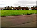
2
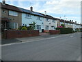
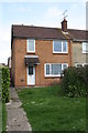
North side of Wolsely Avenue, Park South
The houses are built in blocks of four.
Image: © Christine Johnstone
Taken: 14 Jul 2022
0.06 miles
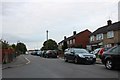
4
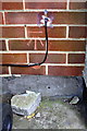
Benchmark on #59 Cranmore Avenue
Ordnance Survey cut mark benchmark described on the Bench Mark Database at http://www.bench-marks.org.uk/bm66085
Image: © Roger Templeman
Taken: 13 Apr 2015
0.08 miles
5
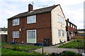
Block of flats on Cranmore Avenue
There is an OS benchmark Image in the bricks right of the black wheelie bin at the near corner of the house
Image: © Roger Templeman
Taken: 13 Apr 2015
0.08 miles
8
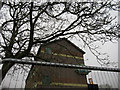
George Gay Gardens Demolition
They were starting to demolish the other block; you can see the crane in the distance. This view isn't possible now, since it's all been demolished.
Image: © Lily
Taken: 8 Apr 2019
0.10 miles
9
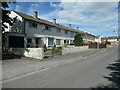
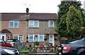
North side of Trentham Close, Park South
The houses are in a block of six.
Image: © Christine Johnstone
Taken: 14 Jul 2022
0.10 miles
10
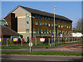
George Gay Gardens, Queens Drive, Swindon (3)
This pair of blocks of maisonettes were built in the 1960s. They comprised pairs of two-storey dwellings one on top of the other. They formed part of the local council's housing stock until they were converted into sheltered housing for elderly residents.
In 2016 the council decided to demolish these structures. The council said “George Gay Gardens is being demolished for two main reasons. Firstly, it was built 50 years ago and doesn’t meet modern standards for sheltered accommodation, having steep stairs and some homes in a bedsit design, and it’s not energy efficient. Secondly, it will allow us to build new care accommodation and much-needed new council homes to help tackle the waiting list for properties.” Residents have since moved out having been found alternative accommodation.
Permission to demolish was granted in 2018 and work looks as though it is about to start fairly soon. The future of the site is unclear at the time of writing.
Image: © Brian Robert Marshall
Taken: 27 Mar 2019
0.12 miles