
IMAGES TAKEN NEAR TO
Concord Walk, SWINDON, SN3 2GG
Introduction
This page details the photographs taken nearby to Concord Walk, SN3 2GG by members of the Geograph project.
The Geograph project started in 2005 with the aim of publishing, organising and preserving representative images for every square kilometre of Great Britain, Ireland and the Isle of Man.

There are currently over 7.5m images from over14,400 individuals and you can help contribute to the project by visiting https://www.geograph.org.uk
Image Map
Images are licensed for reuse under creativecommons.org/licenses/by-sa/2.0
Notes
- Clicking on the map will re-center to the selected point.
- The higher the marker number, the further away the image location is from the centre of the postcode.
Image Listing (24 Images Found)
Images are licensed for reuse under creativecommons.org/licenses/by-sa/2.0
Image
Details
Distance
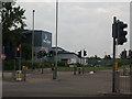
2
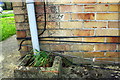
Benchmark on #164 Kingswood Avenue
Ordnance Survey cut mark benchmark described on the Bench Mark Database at http://www.bench-marks.org.uk/bm66083
Image: © Roger Templeman
Taken: 13 Apr 2015
0.11 miles
3
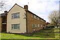
Apartments on Kingswood Avenue
There is an OS benchmark Image on the near corner of the block, right hand face, right of the downpipe
Image: © Roger Templeman
Taken: 13 Apr 2015
0.11 miles
4
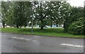
Queen's Drive, Swindon
The streaks are torrential rain which lasted around an hour and flooded many roads to the east.
Image: © David Howard
Taken: 11 Jun 2023
0.13 miles
5
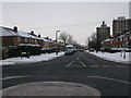
Kingswood Avenue from Whitbourne Avenue, Swindon
Image: © Nick Smith
Taken: 23 Dec 2010
0.13 miles
6
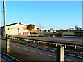
Children's nursery, Shrewsbury Road, Walcot, Swindon
The nursery is a fairly new one and I know little about it. It wasn't here the last time I was in this part of Walcot, quite a few years ago. In the background are houses in Park North, the neighbouring municipal housing estate which was built in the early 1960s.
NOTE. This image has a detailed ‘shared description’ which you won’t see by viewing this image on a slideshow. To read it click on the image.
Image: © Brian Robert Marshall
Taken: 2 Jan 2010
0.13 miles
7
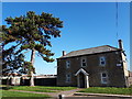
Lower Walcot Farmhouse, Shrewsbury Road
Stone-built former farmhouse, a relic of the past situated in a 1950s housing estate.
Image: © Vieve Forward
Taken: 26 Feb 2019
0.14 miles
8
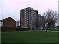
Torrington Court and Milverton Court, Park North
Multi-storey blocks of council flats built in the 1960s.
Image: © Vieve Forward
Taken: 28 Dec 2012
0.15 miles
9
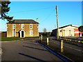
Lower Walcot Farmhouse, Shrewsbury Road, Walcot, Swindon
Dotted around the predominantly 1950s municipal housing estate are reminders of the agricultural past of this area. When Swindon Borough Council purchased the land included with it was the building on the left named on old maps as Lower Walcot. It was used for quite a long time as a depot for the housing department's maintenance division. It then became a hostel, which it still is I understand. The more modern building at the right is a children's nusrsery.
NOTE. This image has a detailed ‘shared description’ which you won’t see by viewing this image on a slideshow. To read it click on the image.
Image: © Brian Robert Marshall
Taken: 2 Jan 2010
0.15 miles
10
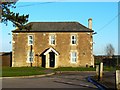
Lower Walcot Farmhouse, Shrewsbury Road, Walcot, Swindon
This image affords a closer view of the farmhouse seen in this image Image The use of the building as a hostel has apparently necessitated the installation of security lights and CCTV cameras.
NOTE. This image has a detailed ‘shared description’ which you won’t see by viewing this image on a slideshow. To read it click on the image.
Image: © Brian Robert Marshall
Taken: 2 Jan 2010
0.15 miles