
IMAGES TAKEN NEAR TO
Ainsworth Road, SWINDON, SN3 2DJ
Introduction
This page details the photographs taken nearby to Ainsworth Road, SN3 2DJ by members of the Geograph project.
The Geograph project started in 2005 with the aim of publishing, organising and preserving representative images for every square kilometre of Great Britain, Ireland and the Isle of Man.

There are currently over 7.5m images from over14,400 individuals and you can help contribute to the project by visiting https://www.geograph.org.uk
Image Map
Images are licensed for reuse under creativecommons.org/licenses/by-sa/2.0
Notes
- Clicking on the map will re-center to the selected point.
- The higher the marker number, the further away the image location is from the centre of the postcode.
Image Listing (40 Images Found)
Images are licensed for reuse under creativecommons.org/licenses/by-sa/2.0
Image
Details
Distance
1
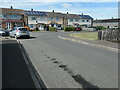
North side of Norcliffe Road, Park South
At the junction with Rosedale Road in one of Swindon's southern suburbs.
Image: © Christine Johnstone
Taken: 14 Jul 2022
0.05 miles
2
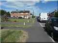
Public open space, Ainsworth Road
Swindon's Park South estate has many small open spaces as well as lots of footpaths.
Image: © Christine Johnstone
Taken: 14 Jul 2022
0.08 miles
3
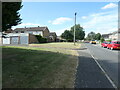
West side of Hillingdon Road, Park South
Swindon's Park South estate has many small open spaces as well as lots of footpaths.
Image: © Christine Johnstone
Taken: 14 Jul 2022
0.09 miles
4
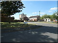
Priory Road, Park South, Swindon
At the junction with Hillingdon Road.
Image: © Christine Johnstone
Taken: 14 Jul 2022
0.13 miles
5
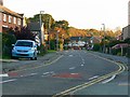
Cranmore Avenue, Park South, Swindon
Cranmore Avenue is the longest road in the municipal housing estate. On the map it can be seen as 'U'' shaped having junctions at each end with Whitbourne Avenue, which runs east-west across the northern edge of the estate.
Image: © Brian Robert Marshall
Taken: 12 Oct 2008
0.13 miles
6

Carstairs Avenue, Swindon
At the junction of Cranmore Avenue
Image: © David Howard
Taken: 9 Sep 2018
0.14 miles
7
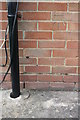
Benchmark on #215-231 Cranmore Avenue
Ordnance Survey cut mark benchmark described on the Bench Mark Database at http://www.bench-marks.org.uk/bm66090
Image: © Roger Templeman
Taken: 13 Apr 2015
0.15 miles
8
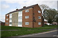
#215-231 Cranmore Avenue
There is an OS benchmark Image on the near corner of the block to the right of the black downpipe and below the satellite dishes
Image: © Roger Templeman
Taken: 13 Apr 2015
0.15 miles
9

Cranmore Avenue, Swindon
From the corner of Keswick Road
Image: © David Howard
Taken: 9 Sep 2018
0.15 miles
10
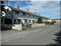
North side of Trentham Close, Park South
The houses are in a block of six.
Image: © Christine Johnstone
Taken: 14 Jul 2022
0.15 miles