IMAGES TAKEN NEAR TO
Thornbridge Avenue, SWINDON, SN3 2BS
Introduction
This page details the photographs taken nearby to Thornbridge Avenue, SN3 2BS by members of the Geograph project.
The Geograph project started in 2005 with the aim of publishing, organising and preserving representative images for every square kilometre of Great Britain, Ireland and the Isle of Man.

There are currently over 7.5m images from over14,400 individuals and you can help contribute to the project by visiting https://www.geograph.org.uk
Image Map
Images are licensed for reuse under creativecommons.org/licenses/by-sa/2.0
Notes
- Clicking on the map will re-center to the selected point.
- The higher the marker number, the further away the image location is from the centre of the postcode.
Image Listing (63 Images Found)
Images are licensed for reuse under creativecommons.org/licenses/by-sa/2.0
Image
Details
Distance
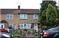
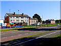
3
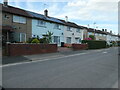
North side of Wolsely Avenue, Park South
The houses are built in blocks of four.
Image: © Christine Johnstone
Taken: 14 Jul 2022
0.07 miles
4
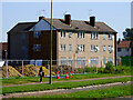
Derelict residential block, Queens Drive, Swindon
Shuttered and empty, demolition awaits this 1960s block of maisonettes.
Image: © Brian Robert Marshall
Taken: 7 Sep 2021
0.09 miles
5
Derelict residential blocks, Queens Drive, Swindon
Following the redevelopment of George Gay Gardens https://www.geograph.org.uk/photo/6955998 these three-storey maisonettes are next in line for the process.
Image: © Brian Robert Marshall
Taken: 7 Sep 2021
0.09 miles
6
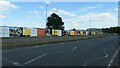
Construction site, Queens Drive, Swindon
Building 'affordable living for the 21st century' on the site of affordable living for the 1950s and 1960s Image
Image: © Christine Johnstone
Taken: 14 Jul 2022
0.09 miles
7
George Gay Gardens Demolition
They were starting to demolish the other block; you can see the crane in the distance. This view isn't possible now, since it's all been demolished.
Image: © Lily
Taken: 8 Apr 2019
0.09 miles
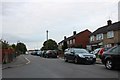
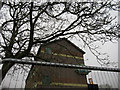
9
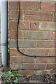
Benchmark on #127-129 Cranmore Avenue
Ordnance Survey cut mark benchmark described on the Bench Mark Database at http://www.bench-marks.org.uk/bm66086
Image: © Roger Templeman
Taken: 13 Apr 2015
0.10 miles
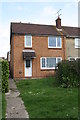
10
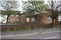
#127-129 Cranmore Avenue
There is an OS benchmark Image on the near corner of the building right of the grey downpipe
Image: © Roger Templeman
Taken: 13 Apr 2015
0.10 miles