
IMAGES TAKEN NEAR TO
Winifred Street, SWINDON, SN3 1RS
Introduction
This page details the photographs taken nearby to Winifred Street, SN3 1RS by members of the Geograph project.
The Geograph project started in 2005 with the aim of publishing, organising and preserving representative images for every square kilometre of Great Britain, Ireland and the Isle of Man.

There are currently over 7.5m images from over14,400 individuals and you can help contribute to the project by visiting https://www.geograph.org.uk
Image Map
Images are licensed for reuse under creativecommons.org/licenses/by-sa/2.0
Notes
- Clicking on the map will re-center to the selected point.
- The higher the marker number, the further away the image location is from the centre of the postcode.
Image Listing (92 Images Found)
Images are licensed for reuse under creativecommons.org/licenses/by-sa/2.0
Image
Details
Distance
1
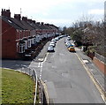
Evelyn Street, Swindon
Viewed from here http://www.geograph.org.uk/photo/3851186 looking along Evelyn Street past the left turn for Marlborough Lane.
Image: © Jaggery
Taken: 14 Apr 2013
0.06 miles
2
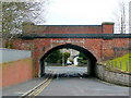
Railway bridge - no railway
Evelyn Street, Swindon old town.
Image: © Jonathan Billinger
Taken: 25 Feb 2009
0.08 miles
3
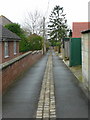
Lane off Marlborough Lane
This services the backs of Evelyn Street.
Image: © Jonathan Billinger
Taken: 25 Feb 2009
0.08 miles
4
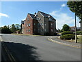
1 & 3 Strouds Close, Swindon
Housing close to the site of the engine shed at the former Swindon Town railway station.
Image: © Christine Johnstone
Taken: 14 Jul 2022
0.09 miles
5
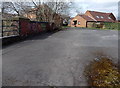
Across a former railway bridge in Swindon
Looking along the top of this http://www.geograph.org.uk/photo/3851161 bridge, towards houses in Berenger Close, built across the former railway trackbed.
Image: © Jaggery
Taken: 14 Apr 2013
0.09 miles
6
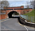
Former railway bridge over Evelyn Street, Swindon
The single-track railway line across this bridge shown on a 1940s map has gone.
The headroom under the bridge (in the middle of the road) is shown as 12' 9" or 3.9 metres.
Image: © Jaggery
Taken: 14 Apr 2013
0.10 miles
7
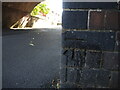
Benchmark on Evelyn Road bridge
The steam trains are a distant past, but the mark remains despite the attentions of the local dogs. See https://www.bench-marks.org.uk/bm175191 for the entry in the Benchmark Database and Image] for a wider view.
Image: © Neil Owen
Taken: 14 Jul 2022
0.10 miles
8
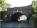
Evelyn Street bridge
Formerly the bridge carried the Midland and South Western Junction railway before its closure in the late 1960s. It had been built to take in the route to the south from the mid 1890s and just up the line was the former Swindon Town station - also gone now.
At the near base is a benchmark - see Image
Image: © Neil Owen
Taken: 14 Jul 2022
0.10 miles
9
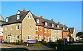
Cotswold Gate, Signal Way, Swindon
Another brownfield site development, this one, still incomplete, is on the site of a car dealership. I'm no architect but this does seem to be an attractive design with the different colours used to break up the uniformity of the terrace.
Image: © Brian Robert Marshall
Taken: 16 Dec 2007
0.10 miles
10

Track along a former railway route in Swindon
The track is between Marlborough Lane on the left and Marlborough Road on the right,
viewed looking north towards a former railway bridge http://www.geograph.org.uk/photo/3851161 over Evelyn Street.
Image: © Jaggery
Taken: 14 Apr 2013
0.10 miles