
IMAGES TAKEN NEAR TO
Marlborough Road, SWINDON, SN3 1NJ
Introduction
This page details the photographs taken nearby to Marlborough Road, SN3 1NJ by members of the Geograph project.
The Geograph project started in 2005 with the aim of publishing, organising and preserving representative images for every square kilometre of Great Britain, Ireland and the Isle of Man.

There are currently over 7.5m images from over14,400 individuals and you can help contribute to the project by visiting https://www.geograph.org.uk
Image Map
Images are licensed for reuse under creativecommons.org/licenses/by-sa/2.0
Notes
- Clicking on the map will re-center to the selected point.
- The higher the marker number, the further away the image location is from the centre of the postcode.
Image Listing (32 Images Found)
Images are licensed for reuse under creativecommons.org/licenses/by-sa/2.0
Image
Details
Distance
1
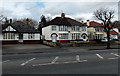
Marlborough Road surgery, Swindon
There is a small sign showing SURGERY on the bungalow on the left.
Image: © Jaggery
Taken: 14 Apr 2013
0.01 miles
3
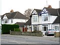
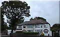
210 Marlborough Road, Swindon
On the face of it, the semi-detached house in the centre of the image is just another example of archetypal English 'between the wars' suburbia. However, it is distinguished from its neighbours by being the house in which the actress and film star Diana Dors spent the first fourteen years of her life. A brief biography of Ms Dors can be found here http://www.swindonweb.com/index.asp?m=8&s=9&ss=220&t=Diana+Dors
Image: © Brian Robert Marshall
Taken: 2 Feb 2008
0.04 miles

5
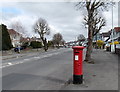
Marlborough Road east of Broome Manor Lane, Swindon
Looking past an Edwardian postbox. http://www.geograph.org.uk/photo/3853730
Image: © Jaggery
Taken: 14 Apr 2013
0.05 miles
6

Edwardian postbox alongside Marlborough Road, Swindon
Located here. http://www.geograph.org.uk/photo/3853725 The monogram showing an ornate ER VII
dates the box to the reign of King Edward VII (1901-1910).
Image: © Jaggery
Taken: 14 Apr 2013
0.06 miles
7
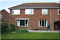
Back of #41 Windsor Road
There is an OS benchmark Image on the left hand side of the house near the corner.
Image: © Roger Templeman
Taken: 22 Apr 2015
0.07 miles
8
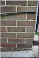
Benchmark on #41 Windsor Road
Ordnance Survey cut mark benchmark described on the Bench Mark Database at http://www.bench-marks.org.uk/bm66430
Image: © Roger Templeman
Taken: 22 Apr 2015
0.08 miles
9
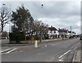
Broome Manor Lane, Swindon
The NW end of Broome Manor Lane, viewed from the edge of the Marlborough Road junction.
Image: © Jaggery
Taken: 14 Apr 2013
0.08 miles
10
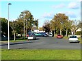
Downs View Road, Swindon
The road is a cul-de-sac. For such a configuration it is unusually wide. I have heard it said that, when the road was planned, the intention was to take it to the south-west, over the railway that then existed and Broome Manor Lane thus forming a relief road round Old Town. Unfortunately for the planners, someone neglected to obtain the necessary permissions or wayleaves from the landowner and the scheme came to nothing. A further legacy is a wide area of green space, the edge of which is visible in the foreground, between the houses on either side, which were built in the 1930s. The bus in the background is in Marlborough Road on its way into Old Town, Swindon.
Image: © Brian Robert Marshall
Taken: 30 Oct 2007
0.11 miles