
IMAGES TAKEN NEAR TO
Walcot Road, SWINDON, SN3 1BH
Introduction
This page details the photographs taken nearby to Walcot Road, SN3 1BH by members of the Geograph project.
The Geograph project started in 2005 with the aim of publishing, organising and preserving representative images for every square kilometre of Great Britain, Ireland and the Isle of Man.

There are currently over 7.5m images from over14,400 individuals and you can help contribute to the project by visiting https://www.geograph.org.uk
Image Map
Images are licensed for reuse under creativecommons.org/licenses/by-sa/2.0
Notes
- Clicking on the map will re-center to the selected point.
- The higher the marker number, the further away the image location is from the centre of the postcode.
Image Listing (66 Images Found)
Images are licensed for reuse under creativecommons.org/licenses/by-sa/2.0
Image
Details
Distance
1
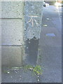
Benchmark on concrete post at junction of Drove Road with Walcot Road
Ordnance Survey cut mark benchmark described on the Bench Mark Database at http://www.bench-marks.org.uk/bm35763
Image: © Roger Templeman
Taken: 15 Oct 2010
0.07 miles
2
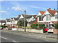
Drove Road
c.1930s housing in Drove Road, although the road itself is much older.
Image: © Ian Capper
Taken: 14 Jul 2022
0.08 miles
3
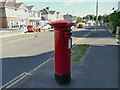
GR postbox on Burford Avenue
Near the corner of Norton Grove.
Image: © Stephen Craven
Taken: 14 Jul 2022
0.08 miles
4
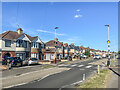
Upham Road
c.1930s housing in Upham Road in the Walcot West suburb of Swindon.
Image: © Ian Capper
Taken: 14 Jul 2022
0.09 miles
5
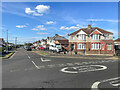
Burford Avenue
c.1930s housing in Burford Avenue in the Walcot West suburb of Swindon.
Image: © Ian Capper
Taken: 14 Jul 2022
0.10 miles
6
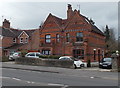
Distinctive semis near Queen's Park, Swindon
These semi-detached houses in Drove Road are unlike neighbouring houses,
except for one nearby detached house. http://www.geograph.org.uk/photo/3804665
Image: © Jaggery
Taken: 14 Apr 2013
0.13 miles
7
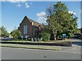
Immanuel Church, Upham Road, Swindon
A United Reformed Church, built in 1939.
Image: © Stephen Craven
Taken: 14 Jul 2022
0.13 miles
8
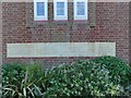
Immanuel Church, Upham Road, Swindon - foundation stones
Several stones laid on 18 January 1939 by various church dignitaries. See Image for context.
Image: © Stephen Craven
Taken: 14 Jul 2022
0.13 miles
9
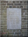
Marking the park's opening
A stone set into the side walls of Queen's Park entrance is somewhat inconspicuous but the engraving marks the details. See Image] for a look at the gates.
Image: © Neil Owen
Taken: 14 Jul 2022
0.13 miles
10
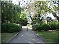
Gates to Queen's Park
The eastern entrance gates are dated from 1960 - see Image] for an engraved stone to the side.
Image: © Neil Owen
Taken: 14 Jul 2022
0.13 miles