
IMAGES TAKEN NEAR TO
Queens Drive, SWINDON, SN3 1AW
Introduction
This page details the photographs taken nearby to Queens Drive, SN3 1AW by members of the Geograph project.
The Geograph project started in 2005 with the aim of publishing, organising and preserving representative images for every square kilometre of Great Britain, Ireland and the Isle of Man.

There are currently over 7.5m images from over14,400 individuals and you can help contribute to the project by visiting https://www.geograph.org.uk
Image Map
Images are licensed for reuse under creativecommons.org/licenses/by-sa/2.0
Notes
- Clicking on the map will re-center to the selected point.
- The higher the marker number, the further away the image location is from the centre of the postcode.
Image Listing (110 Images Found)
Images are licensed for reuse under creativecommons.org/licenses/by-sa/2.0
Image
Details
Distance
1
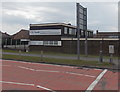
A.E.Smith & Son, Swindon
This is the Queen's Drive (A4259) side of the funeral directors and
monumental stonemasons premises. The main entrance is from Dudmore Road.
Image: © Jaggery
Taken: 14 Apr 2013
0.01 miles
2
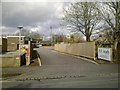
A E Smith and Son, Funeral Directors, Queens Drive, Swindon
Although the postal address of this long-established firm is as in the title, the actual entrance is from Dudmore Road, visible in the foreground. The firm began operating in Swindon in the 1880s nearer the centre of the town and moved to this location in the 1960s.
Image: © Brian Robert Marshall
Taken: 26 Feb 2010
0.02 miles
3

Post Office, Queen's Drive, Swindon
Next to the famous 'Magic Roundabout'.
Image: © Stephen Craven
Taken: 14 Jul 2022
0.02 miles
4

Queens Drive Post Office, Swindon
Located opposite the Magic Roundabout, which contains 5 mini-roundabouts.
Image: © Jaggery
Taken: 14 Apr 2013
0.02 miles
5

Original sign for the Magic Roundabout, 1982, then called County Islands
Taken in February 1982, this is a photo of one of the original road signs at the approach to the Magic Roundabout in Swindon. The roundabout was then named County Islands, being next to the County Ground football stadium, but was eventually officially re-named the Magic Roundabout after being called that for years by locals who had to negotiate it. The present name is a reference to a children's TV programme. https://en.wikipedia.org/wiki/The_Magic_Roundabout
All five original signs were designed and made by Colin Forward, who worked at the Swindon Borough Council workshop in Barnfield Road. He told me how difficult it had been because of course in those days the design was done without the aid of computers and involved a lot of careful measurement to make the separate panels of the signs line up exactly. The letters were pre-cut, but the other features had to be cut by hand and were then printed on metal using a heat process.
Image: © Colin Busby Forward
Taken: 1 Feb 1982
0.02 miles
6

Swindon: The Magic Roundabout, traffic
It seems locals know how to drive through the Magic roundabout.
Image: © Alby
Taken: 29 Dec 2008
0.03 miles
7
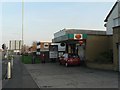
Swindon: Queen?s Drive Post Office
Queen’s Drive runs, as part of the A4259, for about 1½ miles and provides a fast route into the centre of Swindon off the M4 from the east. The Post Office is at the northwestern end, №2 in fact, alongside Image
Image: © Chris Downer
Taken: 4 Nov 2007
0.03 miles
8
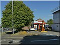
Burger King Drive-Thru, Queen's Drive, Swindon
Near the famous 'Magic Roundabout'.
Image: © Stephen Craven
Taken: 14 Jul 2022
0.04 miles
9
Swindon: Drove Road
Waiting to hit the Magic roundabout.
Image: © Alby
Taken: 29 Dec 2008
0.05 miles
10
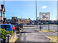
The Magic Roundabout
Entrance off Shrivenham Road onto the Magic Roundabout. The Magic Roundabout was built in 1972 and although at a high level it might be thought of as a single roundabout, in practice it is a series of 5 mini roundabouts arranged in a circle enabling drivers to use the shortest route between their entry and exit point. Prior to construction, the site was a standard roundabout with 3 exits - its expansion followed the construction of Queen's Drive and Fleming Way adding to the number of roads using the junction.
Image: © Ian Capper
Taken: 14 Jul 2022
0.05 miles