IMAGES TAKEN NEAR TO
Minerva Heights, SWINDON, SN26 8AD
Introduction
This page details the photographs taken nearby to Minerva Heights, SN26 8AD by members of the Geograph project.
The Geograph project started in 2005 with the aim of publishing, organising and preserving representative images for every square kilometre of Great Britain, Ireland and the Isle of Man.

There are currently over 7.5m images from over14,400 individuals and you can help contribute to the project by visiting https://www.geograph.org.uk
Image Map
Images are licensed for reuse under creativecommons.org/licenses/by-sa/2.0
Notes
- Clicking on the map will re-center to the selected point.
- The higher the marker number, the further away the image location is from the centre of the postcode.
Image Listing (70 Images Found)
Images are licensed for reuse under creativecommons.org/licenses/by-sa/2.0
Image
Details
Distance
1
Blunsdon by-pass site, Blunsdon, Swindon 01.05.2008
Progress is being made on the major road-building project scheduled for completion by the end of 2008. This is a view facing towards the north-west towards Gloucestershire.
Image: © Brian Robert Marshall
Taken: 1 May 2008
0.02 miles
2
Blunsdon by-pass site, Blunsdon, Swindon 29.11.2007
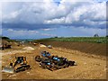
This is a wider view of the by-pass route just north of Lady Lane.
Image: © Brian Robert Marshall
Taken: 29 Nov 2007
0.02 miles
3
Blunsdon by-pass site, Blunsdon 01.07.2008
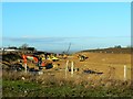
Taken the day after this one http://www.geograph.org.uk/photo/865942 on the day the north-bound carriageway opened to traffic. Progress has been made in the last 24 hours in surfacing the south-bound carriageway.
Image: © Brian Robert Marshall
Taken: 1 Jul 2008
0.03 miles
4
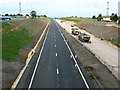
Blunsdon by-pass site, Blunsdon 30.06.2008
Progress has been fairly rapid in the few weeks since this image was taken http://www.geograph.org.uk/photo/792913 to the extent that the north-bound carriageway is expected to be opened to traffic tomorrow. Work on the south-bound carriageway, to the right, is still in progress.
Image: © Brian Robert Marshall
Taken: 30 Jun 2008
0.03 miles
5
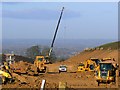
Blunsdon by-pass site, Blunsdon, Swindon 29.11.2007
This major project will route the strategic south-north A419 round the village of Blunsdon when completed in 2008. At present the road passes through Blunsdon effectively cutting it in two. This view is to the north-west. The village is on a hill overlooking the Thames valley. In the middle distance is the small Wiltshire town of Cricklade and beyond that lies Gloucestershire. This and several other photos of the by-pass project can be seen in this gallery: http://www.geograph.org.uk/gallery/the_construction_of_the_blunsdon_bypass_2006_to_2009_10672
Image: © Brian Robert Marshall
Taken: 29 Nov 2007
0.03 miles
6
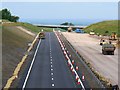
Blunsdon by-pass site, Blunsdon, Swindon 30.06.2008
The north-bound carriageway is to the left. It is virtually complete and will open tomorrow. The view is not directly comparable to this one http://www.geograph.org.uk/photo/622907 because the viewpoint in that image no longer exists except as a point in mid-air.
Image: © Brian Robert Marshall
Taken: 30 Jun 2008
0.03 miles
7
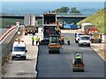
Blunsdon by-pass site, Blunsdon 01.07.2008
Taken on the day the north-bound carriageway opened for traffic, this telephoto image shows work continuing on the south-bound equivalent. This will take longer to complete probably because of the complexity of the work necessary to take the by-pass through the Turnpike junction behind the viewpoint.
Image: © Brian Robert Marshall
Taken: 1 Jul 2008
0.03 miles
8
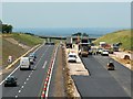
Blunsdon by-pass site, Blunsdon 01.07.2008
Twenty-fours on from when this one http://www.geograph.org.uk/photo/865952 was taken and the north-bound carriageway is open traffic. Now attention will be concentrated on the south-bound carriageway.
Image: © Brian Robert Marshall
Taken: 1 Jul 2008
0.03 miles
9
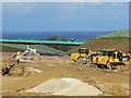
Blunsdon by-pass site, Blunsdon, Swindon 01.05.2008
This image may be compared with this one http://www.geograph.org.uk/photo/622907 taken five months ago. Saplings have been planted and road surfacing is in progress. A bridge has also been constructed.
Image: © Brian Robert Marshall
Taken: 1 May 2008
0.04 miles