
Blunsdon by-pass site, Blunsdon, Swindon 29.11.2007
Introduction
The photograph on this page of Blunsdon by-pass site, Blunsdon, Swindon 29.11.2007 by Brian Robert Marshall as part of the Geograph project.
The Geograph project started in 2005 with the aim of publishing, organising and preserving representative images for every square kilometre of Great Britain, Ireland and the Isle of Man.

There are currently over 7.5m images from over 14,400 individuals and you can help contribute to the project by visiting https://www.geograph.org.uk
Blunsdon by-pass site, Blunsdon, Swindon 29.11.2007
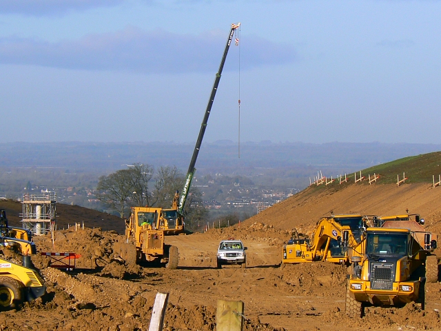
Image: © Brian Robert Marshall Taken: 29 Nov 2007
This major project will route the strategic south-north A419 round the village of Blunsdon when completed in 2008. At present the road passes through Blunsdon effectively cutting it in two. This view is to the north-west. The village is on a hill overlooking the Thames valley. In the middle distance is the small Wiltshire town of Cricklade and beyond that lies Gloucestershire. This and several other photos of the by-pass project can be seen in this gallery: http://www.geograph.org.uk/gallery/the_construction_of_the_blunsdon_bypass_2006_to_2009_10672
Images are licensed for reuse under creativecommons.org/licenses/by-sa/2.0
Image Location

Latitude
51.609818
Longitude
-1.79157