IMAGES TAKEN NEAR TO
Ruby Close, SWINDON, SN25 2SU
Introduction
This page details the photographs taken nearby to Ruby Close, SN25 2SU by members of the Geograph project.
The Geograph project started in 2005 with the aim of publishing, organising and preserving representative images for every square kilometre of Great Britain, Ireland and the Isle of Man.

There are currently over 7.5m images from over14,400 individuals and you can help contribute to the project by visiting https://www.geograph.org.uk
Image Map
Images are licensed for reuse under creativecommons.org/licenses/by-sa/2.0
Notes
- Clicking on the map will re-center to the selected point.
- The higher the marker number, the further away the image location is from the centre of the postcode.
Image Listing (26 Images Found)
Images are licensed for reuse under creativecommons.org/licenses/by-sa/2.0
Image
Details
Distance
1
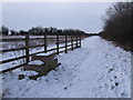
Mounting block (?), Blunsdon St Andrew
This mounting block (if that's what it is) was presumably placed here when the Widhill Walk bridge (behind the photographer) taking the bridleway across the A419 dual carriageway was built. The bridge crosses very high above a hectic road, and on the other side are steps leading up to it from Widhill Lane, so it is probably better to lead a horse rather than ride it across.
Image: © Vieve Forward
Taken: 22 Jan 2013
0.05 miles
2
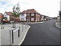
Sapphire Road
A new housing development on a hill top.
Image: © Richard Webb
Taken: 31 Aug 2022
0.06 miles
3
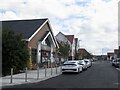
Co-op, Blunsdon Hill
Not yet open but very nearly completed.
Image: © Richard Webb
Taken: 31 Aug 2022
0.07 miles
4
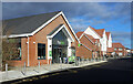
Co-op Store, Diamond Crescent
Only recently opened. Richard Webb's picture from 5 months ago Image shows contractors still finishing off the frontage.
Diamond Crescent is one of a number of nearby streets to have the name of a gemstone.
Image: © Des Blenkinsopp
Taken: 30 Jan 2023
0.08 miles
5
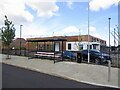
Primary school, Blunsdon Hill
A newly built school.
Image: © Richard Webb
Taken: 31 Aug 2022
0.08 miles
6
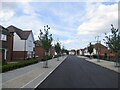
On Blunsdon Hill
Diamond Crescent in a newly built housing development.
Image: © Richard Webb
Taken: 31 Aug 2022
0.10 miles
7
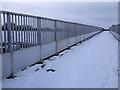
Widhill Walk Bridge, Blunsdon
This bridge carries a bridleway across the A419 dual carriageway.
Image: © Vieve Forward
Taken: 22 Jan 2013
0.11 miles