
IMAGES TAKEN NEAR TO
Pasture Close, SWINDON, SN2 2UH
Introduction
This page details the photographs taken nearby to Pasture Close, SN2 2UH by members of the Geograph project.
The Geograph project started in 2005 with the aim of publishing, organising and preserving representative images for every square kilometre of Great Britain, Ireland and the Isle of Man.

There are currently over 7.5m images from over14,400 individuals and you can help contribute to the project by visiting https://www.geograph.org.uk
Image Map
Images are licensed for reuse under creativecommons.org/licenses/by-sa/2.0
Notes
- Clicking on the map will re-center to the selected point.
- The higher the marker number, the further away the image location is from the centre of the postcode.
Image Listing (82 Images Found)
Images are licensed for reuse under creativecommons.org/licenses/by-sa/2.0
Image
Details
Distance
1
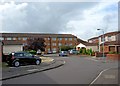
St. Albans Close
This is a modern housing development, which in effect is an extension to Hughes Street, in the Rodbourne area of Swindon. The most noticeable building is Margaret Matthews Court, a sheltered housing scheme with flats/bedsits, managed by Kennet Housing Society Limited.
Image: © P L Chadwick
Taken: 5 Oct 2010
0.06 miles
4
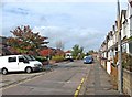
Drew Street
This street is typical of many in the Rodbourne area, with a combination of both modern housing, and much older residential properties. The latter date from 1907, and were designed by William Drew, a local architect. The street was named after him. The modern properties in this street are mainly flats, known as Mannington Court, built since the turn of the present century.
Image: © P L Chadwick
Taken: 5 Oct 2010
0.12 miles
5
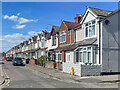
Drew Street
Early 20th Century housing in Drew Street, seen from where it crosses Morris Street. The street was first shown on the 1923 25 inch map.
Image: © Ian Capper
Taken: 14 Jul 2022
0.14 miles
6
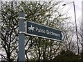
Bridleway signpost, Barnfield Road, Swindon
The bridleway indicated skirts the southern perimeter of land formerly used as allotments.
Image: © Brian Robert Marshall
Taken: 15 Mar 2007
0.15 miles
7
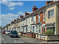
Montagu Street
Early 20th Century terraced housing in Montagu Street, seen from where it crosses Morris Street. The street was first shown on the 1923 25 inch map.
Image: © Ian Capper
Taken: 14 Jul 2022
0.15 miles
8

Benchmark on #67 Montagu Street
Ordnance Survey cut mark benchmark described on the Bench Mark Database at http://www.bench-marks.org.uk/bm74261
Image: © Roger Templeman
Taken: 15 Mar 2016
0.15 miles
9
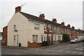
Houses at Morris Street / Montagu Street junction
There is an OS benchmark Image on the corner, left hand face, of the nearest house
Image: © Roger Templeman
Taken: 15 Mar 2016
0.15 miles
10
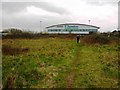
Thamesdown Transport depot, Barnfield Road, Swindon
The depot occupies the site that previously was used as a municipal refuse incinerator. It was never that successful and only lasted about 15 years before closing. The bus depot was formerly in the centre of Swindon and the bus company outgrew it after many years there. The land in the foreground was previously an allotment site. Unfortunately, some years ago it was found that the land was contaminated with lead and was vacated. It remains in the local Council's landbank.
Update July 2009: the land in the foreground is being made ready for the construction of a supermarket http://www.geograph.org.uk/photo/1382636
Image: © Brian Robert Marshall
Taken: 15 Mar 2007
0.15 miles