
IMAGES TAKEN NEAR TO
Rose Street, SWINDON, SN2 2HJ
Introduction
This page details the photographs taken nearby to Rose Street, SN2 2HJ by members of the Geograph project.
The Geograph project started in 2005 with the aim of publishing, organising and preserving representative images for every square kilometre of Great Britain, Ireland and the Isle of Man.

There are currently over 7.5m images from over14,400 individuals and you can help contribute to the project by visiting https://www.geograph.org.uk
Image Map
Images are licensed for reuse under creativecommons.org/licenses/by-sa/2.0
Notes
- Clicking on the map will re-center to the selected point.
- The higher the marker number, the further away the image location is from the centre of the postcode.
Image Listing (193 Images Found)
Images are licensed for reuse under creativecommons.org/licenses/by-sa/2.0
Image
Details
Distance
1
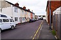
Terraced houses in Horace Street, Rodbourne, Swindon
The houses in this short street, like most of those in Rodbourne, were built in Victorian times. The street was built on the site of North Laines Farmhouse. The houses have front doors which open directly onto the pavement. For many decades the housing in Rodbourne was mainly occupied by employees of the former Great Western Railway works and their families.
Image
Image: © P L Chadwick
Taken: 19 Apr 2015
0.03 miles
2
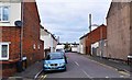
Horace Street, Rodbourne, Swindon
A short street of terraced housing, and which is a turning off Jennings Street. The houses in Horace Street have front doors which open directly onto the pavement.
Image
Image: © P L Chadwick
Taken: 19 Apr 2015
0.04 miles
3
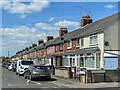
Rose Street
Early 20th Century terraced housing in Rose Street, seen from where it crosses Morris Street. The street was shown as laid out on the 1923 25 inch map, but with no development on this section.
Image: © Ian Capper
Taken: 14 Jul 2022
0.06 miles
4
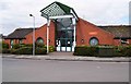
Even Swindon Community Centre, Jennings Street, Rodbourne, Swindon
The centre is built on the site of the former Jennings Street School. The local library is housed in the centre.
Image: © P L Chadwick
Taken: 19 Apr 2015
0.06 miles
5
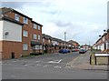
Rose Street
The older parts of Rodbourne were laid out on a grid pattern, with mainly terraced housing. In recent years there has been much infilling and extension, with modern housing, some of which has been built on the sites of demolished buildings, or on former allotment land. Rose Street is typical in containing both old and new housing stock.
Image: © P L Chadwick
Taken: 5 Oct 2010
0.06 miles
6
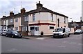
Rice House Chinese Takeaway, 39 Jennings Street, Rodbourne, Swindon
Located on the corner of Jennings Street and Groves Street. Previously the takeaway business here was the Great Wall Fish Bar.
Image: © P L Chadwick
Taken: 19 Apr 2015
0.07 miles
7
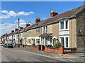
Morrison Street
Turn of the 19th/20th Century terraced housing in Morrison Street, seen from where it crosses Morris Street. The street was shown as laid out on the 1900 25 inch map, but with no development on this section.
Image: © Ian Capper
Taken: 14 Jul 2022
0.07 miles
8
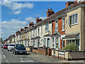
Montagu Street
Early 20th Century terraced housing in Montagu Street, seen from where it crosses Morris Street. The street was first shown on the 1923 25 inch map.
Image: © Ian Capper
Taken: 14 Jul 2022
0.08 miles
9
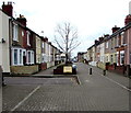
Morris Street, Swindon
Looking SW from the middle of the 160 metre long pedestrianised zone at the NE end of Morris Street.
Distant cars are parked near the edge of the zone. The road on the left leads to a parking area.
Image: © Jaggery
Taken: 15 Mar 2015
0.08 miles
10
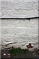
Benchmark on #67 Montagu Street
Ordnance Survey cut mark benchmark described on the Bench Mark Database at http://www.bench-marks.org.uk/bm74261
Image: © Roger Templeman
Taken: 15 Mar 2016
0.09 miles