
IMAGES TAKEN NEAR TO
Pinehurst Road, SWINDON, SN2 1RH
Introduction
This page details the photographs taken nearby to Pinehurst Road, SN2 1RH by members of the Geograph project.
The Geograph project started in 2005 with the aim of publishing, organising and preserving representative images for every square kilometre of Great Britain, Ireland and the Isle of Man.

There are currently over 7.5m images from over14,400 individuals and you can help contribute to the project by visiting https://www.geograph.org.uk
Image Map
Images are licensed for reuse under creativecommons.org/licenses/by-sa/2.0
Notes
- Clicking on the map will re-center to the selected point.
- The higher the marker number, the further away the image location is from the centre of the postcode.
Image Listing (59 Images Found)
Images are licensed for reuse under creativecommons.org/licenses/by-sa/2.0
Image
Details
Distance
1
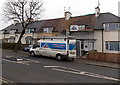
J&S van, Pinehurst Road, Swindon
J&S roofing & building specialists at work in December 2014.
Image: © Jaggery
Taken: 1 Dec 2014
0.02 miles
2
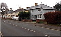
Houses near the southern end of Pinehurst Road, Swindon
Viewed from the end of a houseless section of Pinehurst Road extending for c220 metres behind the camera.
Image: © Jaggery
Taken: 1 Dec 2014
0.05 miles
3
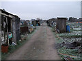
Pickards Field allotments
Swindon's largest allotment site, Pickards Field (west of Pinehurst Road) contains 193 plots. Not to be confused with Pickards Small Field (east of Pinehurst Road), a former allotment site which was sold off for housing. The picture shows the main through track looking south, with the David Murray John tower visible in the distance. Pickards Field was once part of Southbrook Farm; the former farmhouse is now a public house, the Southbrook Inn.
Image: © Vieve Forward
Taken: 17 Jan 2012
0.07 miles
4
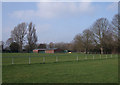
Football pitch and Parks Department building, Pinehurst
This large green space east of Pinehurst Road is popular with dog walkers, but on Sundays is alive with the sounds of football players and spectators. The brick building in the background is the workplace of members of Swindon Council's Parks Department.
Image: © Vieve Forward
Taken: 31 Jan 2012
0.08 miles
5
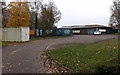
Access road from Pinehurst Road to a pavilion, Swindon
The building is in the NW corner of a recreation ground.
Image: © Jaggery
Taken: 1 Dec 2014
0.08 miles
6
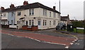
From Pinehurst Road to St Marys Grove, Swindon
The name sign on the right shows PINEHURST ROAD.
The one alongside the wall in the middle of the view shows ST MARYS GROVE (no apostrophe).
Image: © Jaggery
Taken: 1 Dec 2014
0.08 miles
7
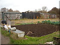
Old railway carriages, Pickards Field allotments, Pinehurst Road
Three old railway carriages and a container used for storage for goods for the Pickards Field allotment shop, which can be seen behind them.
Image: © Vieve Forward
Taken: 5 Dec 2014
0.09 miles
8
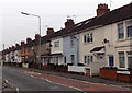
St Marys Grove houses, Swindon
Houses on the west side of the road, viewed from the southern end of Pinehurst Road.
There is no apostrophe in the name sign on the right which shows ST MARYS GROVE.
Image: © Jaggery
Taken: 1 Dec 2014
0.10 miles
9
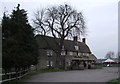
Southbrook Inn, Hunters Grove
A Grade II Listed Building, the Southbrook Inn was formerly a farmhouse until the northward expansion of Swindon in the early 20th century, when the Southbrook Farm area was included in the Borough of Swindon. Some of the former farm fields were converted to allotments (Pickard's Field) which are still worked to this day.
Image: © Vieve Forward
Taken: 17 Jan 2012
0.14 miles
10
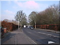
Beech hedges, Pinehurst Road
Mature beech hedges line Pinehurst Road, dividing the southern from the northern sections. Note the speed bumps on the road.
Image: © Vieve Forward
Taken: 31 Jan 2012
0.14 miles