
IMAGES TAKEN NEAR TO
Churchward Avenue, SWINDON, SN2 1NN
Introduction
This page details the photographs taken nearby to Churchward Avenue, SN2 1NN by members of the Geograph project.
The Geograph project started in 2005 with the aim of publishing, organising and preserving representative images for every square kilometre of Great Britain, Ireland and the Isle of Man.

There are currently over 7.5m images from over14,400 individuals and you can help contribute to the project by visiting https://www.geograph.org.uk
Image Map
Images are licensed for reuse under creativecommons.org/licenses/by-sa/2.0
Notes
- Clicking on the map will re-center to the selected point.
- The higher the marker number, the further away the image location is from the centre of the postcode.
Image Listing (29 Images Found)
Images are licensed for reuse under creativecommons.org/licenses/by-sa/2.0
Image
Details
Distance
1
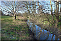
Stream in the Park
The map doesn't show a name for this stream, but the surrounding area is called Rodbourne so that's probably a clue.
A short tributary of the River Ray.
Image: © Des Blenkinsopp
Taken: 19 Jan 2020
0.09 miles
2
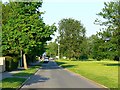
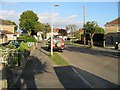
Tovey Road, Pinehurst, Swindon
This is a view facing east. Tovey Road marks the southern extent of the post-war local authority-built housing estate. To the south, on the other side of the water course seen on the map, is a pre-war area of private housing.
Image: © Brian Robert Marshall
Taken: 13 May 2008
0.11 miles
3
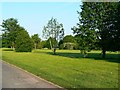
Public open space, south of Tovey Road, Pinehurst, Swindon
This area of open space lies between a small watercourse named Hreod Burna and Tovey Road. The stream flows west to the River Ray, a tributary of the Thames.
Image: © Brian Robert Marshall
Taken: 13 May 2008
0.13 miles
4
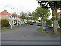
Cornwall Avenue, off Northern Road
Sign reads "Cornwall Avenue leading to Devon Road and Southbrook Street Ext"
Image: © Nick Smith
Taken: 16 Sep 2007
0.15 miles
5
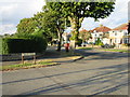
Junction of Collett Avenue with Northern Road
Image: © Nick Smith
Taken: 16 Sep 2007
0.15 miles
6
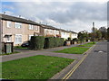
Post war 'temporary' houses, Northern Road
Originally designed to be replaced decades ago, many of these houses still remain. "Post-war shortages of labour and materials are reflected in some of the houses where non-traditional materials and methods of construction were employed. Extensive use was made of the Easiform House, designed and erected by Messrs. John Laing & Son, Ltd. and of the Airey House, both built substantially of concrete".
From: 'Swindon: Growth of the town', A History of the County of Wiltshire: Volume 9 (1970), pp. 104-119. URL: http://www.british-history.ac.uk/report.aspx?
Image: © Nick Smith
Taken: 28 Oct 2009
0.16 miles
7
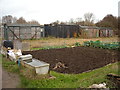
Old railway carriages, Pickards Field allotments, Pinehurst Road
Three old railway carriages and a container used for storage for goods for the Pickards Field allotment shop, which can be seen behind them.
Image: © Vieve Forward
Taken: 5 Dec 2014
0.16 miles
8
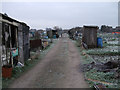
Pickards Field allotments
Swindon's largest allotment site, Pickards Field (west of Pinehurst Road) contains 193 plots. Not to be confused with Pickards Small Field (east of Pinehurst Road), a former allotment site which was sold off for housing. The picture shows the main through track looking south, with the David Murray John tower visible in the distance. Pickards Field was once part of Southbrook Farm; the former farmhouse is now a public house, the Southbrook Inn.
Image: © Vieve Forward
Taken: 17 Jan 2012
0.17 miles
10
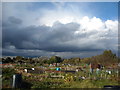
Pickards Field Allotments, Pinehurst
A large allotment site off Pinehurst Road consisting of 193 plots.
Image: © Vieve Forward
Taken: 11 Oct 2014
0.17 miles