
IMAGES TAKEN NEAR TO
Rowan Road, SWINDON, SN2 1JA
Introduction
This page details the photographs taken nearby to Rowan Road, SN2 1JA by members of the Geograph project.
The Geograph project started in 2005 with the aim of publishing, organising and preserving representative images for every square kilometre of Great Britain, Ireland and the Isle of Man.

There are currently over 7.5m images from over14,400 individuals and you can help contribute to the project by visiting https://www.geograph.org.uk
Image Map
Images are licensed for reuse under creativecommons.org/licenses/by-sa/2.0
Notes
- Clicking on the map will re-center to the selected point.
- The higher the marker number, the further away the image location is from the centre of the postcode.
Image Listing (39 Images Found)
Images are licensed for reuse under creativecommons.org/licenses/by-sa/2.0
Image
Details
Distance
1
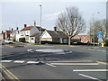
Mini-roundabout at junction of Whitworth Road and Thames Avenue,Swindon
Mini-roundabouts are common in this part of Swindon. This one is at a T-junction.
A cyclist is entering Thames Avenue, on the right.
Image: © Jaggery
Taken: 12 Mar 2011
0.06 miles
3

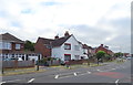
Elizabeth II postbox on Whitworth Road
Outside the former Post Office.
Postbox No. SN25 165.
See Image] for context.
Image: © JThomas
Taken: 15 Jul 2019
0.07 miles
4
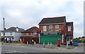
Former Post Office on Whitworth Road
Showing position of Postbox No. SN25 160.
See Image] for postbox.
Image: © JThomas
Taken: 15 Jul 2019
0.07 miles
5
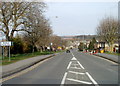
Southern edge of Haydon Wick, Swindon
The Parish of Haydon Wick sign is at the southern end of Thames Avenue, opposite the mini-roundabout http://www.geograph.org.uk/photo/2304935 at the Whitworth Road junction.
Image: © Jaggery
Taken: 12 Mar 2011
0.09 miles
6
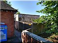
Disused public conveniences, Whitworth Road, Swindon (2)
These conveniences have been out of service for a long time. Owned by the local council they are to be demolished in the near future according to reports. The brick building to the left is an electricity substation.
Image: © Brian Robert Marshall
Taken: 16 Jul 2019
0.09 miles
7
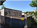
Disused public conveniences, Whitworth Road, Swindon (1)
These conveniences have been out of service for a long time. Owned by the local council they are to be demolished in the near future according to reports.
Image: © Brian Robert Marshall
Taken: 16 Jul 2019
0.09 miles
8
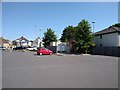
Car park, Farmfoods Ltd, Whitworth Road, Swindon
The small, light-coloured building in the centre contains what were once public conveniences. They have been closed for many a year and are due to be demolished soon.
Image: © Brian Robert Marshall
Taken: 16 Jul 2019
0.10 miles
9
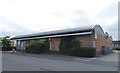
Co-operative food store and Post Office, Rodbourne Cheney
On Cheney Manor Road.
Image: © JThomas
Taken: 15 Jul 2019
0.11 miles
10
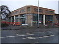
New supermarket, corner of Cheney Manor Road
This is the new Farmfoods supermarket in the process of being built on the site of the demolished Rodbourne Arms public house on the junction of Cheney Manor Road and Whitworth Road.
Image: © Vieve Forward
Taken: 18 Feb 2012
0.11 miles