
IMAGES TAKEN NEAR TO
St. Pauls Street, SWINDON, SN2 1AY
Introduction
This page details the photographs taken nearby to St. Pauls Street, SN2 1AY by members of the Geograph project.
The Geograph project started in 2005 with the aim of publishing, organising and preserving representative images for every square kilometre of Great Britain, Ireland and the Isle of Man.

There are currently over 7.5m images from over14,400 individuals and you can help contribute to the project by visiting https://www.geograph.org.uk
Image Map
Images are licensed for reuse under creativecommons.org/licenses/by-sa/2.0
Notes
- Clicking on the map will re-center to the selected point.
- The higher the marker number, the further away the image location is from the centre of the postcode.
Image Listing (134 Images Found)
Images are licensed for reuse under creativecommons.org/licenses/by-sa/2.0
Image
Details
Distance
1
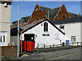
Playgroup, St Paul's Street, Swindon
The playgroup occupies what was once a 'tin tabernacle'. I don't know much about the history of the building but I suspect it was the original Gorse Hill Methodist Church which is the rather more substantial building behind it.
Image: © Brian Robert Marshall
Taken: 11 Sep 2009
0.01 miles
2
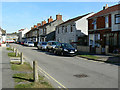
Norman Road and St Paul's Street, Swindon
Norman Road runs into St Paul's Street at a point just behind the third car on the right. St Paul's Street was built in the late 19th century and old maps from that era show it. Norman Road was developed in the 20th century, probably in the years before and after the Great War. The bus in the distance is in Cricklade Road.
Image: © Brian Robert Marshall
Taken: 11 Sep 2009
0.02 miles
3
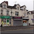
Z Polski do Anglii, Gorse Hill, Swindon
Z Polski do Anglii (Polish for From Poland to England) is a Polish food shop in Cricklade Road.
Image: © Jaggery
Taken: 1 Dec 2014
0.02 miles
4
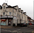
A&K News, Gorse Hill, Swindon
On the corner of Cricklade Road and St Paul's Street, opposite New Swindon Balti. http://www.geograph.org.uk/photo/4364579
Image: © Jaggery
Taken: 1 Dec 2014
0.02 miles
5
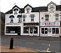
Beijing Chef in Gorse Hill, Swindon
Chinese takeaway at 119 Cricklade Road. Rafu's Indian takeaway is on the right.
Image: © Jaggery
Taken: 1 Dec 2014
0.02 miles
6
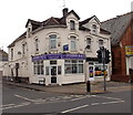
New Swindon Balti, Gorse Hill, Swindon
Restaurant & takeaway on the corner of Cricklade Road and St Paul's Street.
Image: © Jaggery
Taken: 1 Dec 2014
0.02 miles
7
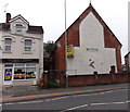
The Touch of Thailand in Gorse Hill, Swindon
Thai Spa in Cricklade Road. A former Methodist church http://www.geograph.org.uk/photo/4364602 is on the right.
Image: © Jaggery
Taken: 1 Dec 2014
0.03 miles
8
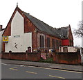
Derelict former Methodist church in Cricklade Road, Gorse Hill, Swindon
Viewed in early December 2014 when there is a SOLD sticker on the FREEHOLD FOR SALE board on the wall. The building was latterly used as the Bangladeshi Youth and Community Centre.
Image: © Jaggery
Taken: 1 Dec 2014
0.03 miles
9

The Open Door Centre, Gorse Hill, Swindon
Located in St Barnabas Church Hall, the Open Door Centre provides a specialist day resource for adults with learning disabilities, who may also have physical disabilities and mental health issues, or both.
Image: © Jaggery
Taken: 1 Dec 2014
0.03 miles
10

St Barnabas, Gorse Hill, Swindon
Built in 1885 to a design by John Pollard Seddon at the main Gorse Hill crossroads. The nearly detached porch was intended to be a tower.
Image: © Chris Brown
Taken: 21 Mar 2018
0.03 miles