
IMAGES TAKEN NEAR TO
Stonehenge Road, SWINDON, SN1 7AH
Introduction
This page details the photographs taken nearby to Stonehenge Road, SN1 7AH by members of the Geograph project.
The Geograph project started in 2005 with the aim of publishing, organising and preserving representative images for every square kilometre of Great Britain, Ireland and the Isle of Man.

There are currently over 7.5m images from over14,400 individuals and you can help contribute to the project by visiting https://www.geograph.org.uk
Image Map
Images are licensed for reuse under creativecommons.org/licenses/by-sa/2.0
Notes
- Clicking on the map will re-center to the selected point.
- The higher the marker number, the further away the image location is from the centre of the postcode.
Image Listing (77 Images Found)
Images are licensed for reuse under creativecommons.org/licenses/by-sa/2.0
Image
Details
Distance
1
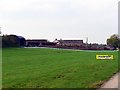
Westlecott Farm, Old Town, Swindon
The farm is now derelict following the commencement of work to develop the area for new housing. I imagine it will be demolished at some point as there is nothing there worth preserving.
Image: © Brian Robert Marshall
Taken: 14 Oct 2007
0.01 miles
2
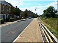
West along Stonehenge Road, Wichelstowe, Swindon
The houses here are part of the Wichelstowe development on land once called colloquially Swindon's front garden. The view was a little different in 2007 when I last photographed it http://www.geograph.org.uk/photo/584093 from a viewpoint that is now inside a school playground.
Image: © Brian Robert Marshall
Taken: 29 Jul 2014
0.02 miles
3
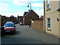
Stonehenge Road, Wichelstowe, Swindon
This part of the new residential development is situated on the site of a farmhouse built probably in the 1960s and which I photographed in 2007 before it was demolished http://www.geograph.org.uk/photo/584095 The viewpoint is not quite the same - it would have been a closeup of a wall - but it's close enough to make a fair comparison.
Image: © Brian Robert Marshall
Taken: 29 Jul 2014
0.02 miles
4
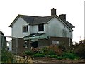
Westlecott Farmhouse, Old Town, Swindon
This is the now-derelict farmhouse associated with the defunct farm of the same name. The farmhouse and barns are now within the 'Front Garden' development area and will no doubt be demolished as construction proceeds. The house doesn't look that old and is unremarkable. Update 2014: this location looks different now http://www.geograph.org.uk/photo/4096352
Image: © Brian Robert Marshall
Taken: 14 Oct 2007
0.02 miles
5
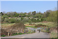
Wichelstowe Footbridge
Bridge heading towards the old railway path.
Image: © Wayland Smith
Taken: 10 Apr 2020
0.04 miles
6
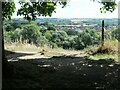
View south to East Wichel
From the former Midland & South Western Junction Railway, which runs west-east along the southern edge of Swindon and is now part of NCR 45. East Wichel is an outer suburb of Swindon, between the River Ray and the M4.
Image: © Christine Johnstone
Taken: 14 Jul 2022
0.05 miles
7
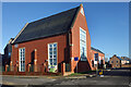
East Wychel Primary School
Wychelstowe is a new urban village which incorporates a lot of the designs and layouts of days gone by to create its character.
This is the village school.
Image: © Des Blenkinsopp
Taken: 19 Jan 2023
0.05 miles
8
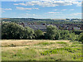
East Wichel
Looking down to the early 2000s development of East Wichel from by the Old Town Railway Path.
Image: © Ian Capper
Taken: 14 Jul 2022
0.06 miles
9
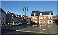
Trevello Road, Wychelstowe
A small plaza near the village centre.
Image: © Des Blenkinsopp
Taken: 19 Jan 2023
0.06 miles
10
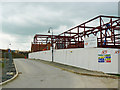
East Wichel Primary School site, Wichelstowe, Swindon
The school is scheduled to open in September 2011 and will have 420 places. Temporary arrangements for schooling are being made off-site. More on Wichelstowe here http://www.wichelstowe.co.uk/index.asp?pageid=1
Image: © Brian Robert Marshall
Taken: 20 May 2010
0.06 miles