
IMAGES TAKEN NEAR TO
Bisley, MALMESBURY, SN16 9DJ
Introduction
This page details the photographs taken nearby to Bisley, SN16 9DJ by members of the Geograph project.
The Geograph project started in 2005 with the aim of publishing, organising and preserving representative images for every square kilometre of Great Britain, Ireland and the Isle of Man.

There are currently over 7.5m images from over14,400 individuals and you can help contribute to the project by visiting https://www.geograph.org.uk
Image Map
Images are licensed for reuse under creativecommons.org/licenses/by-sa/2.0
Notes
- Clicking on the map will re-center to the selected point.
- The higher the marker number, the further away the image location is from the centre of the postcode.
Image Listing (32 Images Found)
Images are licensed for reuse under creativecommons.org/licenses/by-sa/2.0
Image
Details
Distance
1
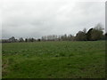
Charlton, crop field
A field of young brassicas, with Charlton Park just visible in the distance.
Image: © Mike Faherty
Taken: 11 Mar 2011
0.08 miles
2
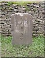
Old Milestone by the B4040, Charlton Road, Charlton
Stone post (plate lost) by the B4040, in parish of Charlton (North Wiltshire District), Charlton Road, Western approach to Charlton, opposite Coltsacre, on verge, on Northwest side of road. Malmesbury iron plate, erected by the Faringdon to Acton Turville (2nd District) turnpike trust in the 19th century.
Inscription once read:-
(MINETY)
(5)
(MALMESBURY)
(2)
Carved benchmark on lower face.
Grade II listed.
List Entry Number: 1284958 https://historicengland.org.uk/listing/the-list/list-entry/1284958
Milestone Society National ID: WI_MYCK02
Image: © A Rosevear
Taken: 20 May 2003
0.08 miles
3
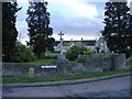
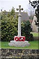
War memorial, Charlton
Located at the main village crossroads.
Image: © Roger Cornfoot
Taken: 14 Jan 2007
0.11 miles
4
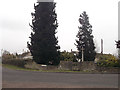
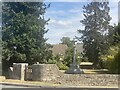
The Street Charlton
The war memorial can be seen behind the wall
Image: © John Firth
Taken: 11 Apr 2013
0.13 miles
5
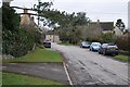
The village of Charlton
Road through the village of Charlton giving access to a few dwellings, the parish church and the gates to Charlton Park.
Image: © Philip Halling
Taken: 17 Mar 2018
0.13 miles
7
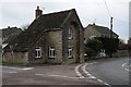
Turnpike Cottage, Charlton
The British History Online website indicates this former turnpike house on the Malmesbury to Cricklade road was built around 1808, the road was disturnpiked in 1876.
Image: © Philip Halling
Taken: 17 Mar 2018
0.13 miles
10
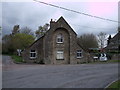
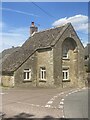
Former Toll House, The Street, Charlton
Former road Toll House, The Street, Charlton. Thought to have been built for the Faringdon-Acton Turville Turnpike Trust in the 19th century in the form of a lodge house with protruding front. Currently a domestic property with some additions or alteration to the original tollhouse structure. http://www.flickr.com/photos/tollhouses/2127859227/ The Cricklade—Malmesbury road was turnpiked in 1756, disturnpiked in 1876. The turnpike house at the crossroads was apparently built c. 1808. http://www.british-history.ac.uk/report.aspx?compid=116140
Image: © Vieve Forward
Taken: 22 Apr 2012
0.15 miles