IMAGES TAKEN NEAR TO
Luckington Road, MALMESBURY, SN16 0QA
Introduction
This page details the photographs taken nearby to Luckington Road, SN16 0QA by members of the Geograph project.
The Geograph project started in 2005 with the aim of publishing, organising and preserving representative images for every square kilometre of Great Britain, Ireland and the Isle of Man.

There are currently over 7.5m images from over14,400 individuals and you can help contribute to the project by visiting https://www.geograph.org.uk
Image Map
Images are licensed for reuse under creativecommons.org/licenses/by-sa/2.0
Notes
- Clicking on the map will re-center to the selected point.
- The higher the marker number, the further away the image location is from the centre of the postcode.
Image Listing (10 Images Found)
Images are licensed for reuse under creativecommons.org/licenses/by-sa/2.0
Image
Details
Distance
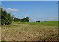
1
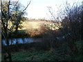
Carrier's Farm, from the Macmillan Way
The Macmillan Way, or Cross Cotswold Pathway http://www.macmillanway.org/index_files/route_national.htm , at this point (between Sherston and Luckington) runs alongside a stream and through a stretch of woodland, 'The Grove'. On the other side of the stream is Carrier's Farm.
Image: © HelenK
Taken: 1 Jan 2018
0.03 miles
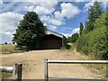
3
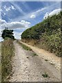
Gated farm track off the B4040 near Angel Farm
Image: © JThomas
Taken: 14 Jul 2019
0.12 miles
7
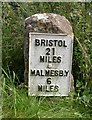
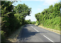
Old Milestone by the B4040, Luckington Road, Sherston parish
Metal plate attached to stone post by the B4040, in parish of SHERSTON (NORTH WILTSHIRE District), Luckington Road; 150m West of Avon bridge, on the verge, on South side of road. Malmesbury iron plate, erected by the Faringdon to Acton Turville (2nd District) turnpike trust in the 19th century.
Inscription reads:-
BRISTOL
21
MILES
MALMESB,Y
6
MILES
Grade II listed.
List Entry Number: 1356018 https://historicengland.org.uk/listing/the-list/list-entry/1356018
Milestone Society National ID: WI_MYBR06.
Image: © M Faherty
Taken: 21 Jul 2007
0.18 miles
8
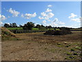
Muck Heap
This farm manure pile is just off the B4040 south west of Sherston. The field had been recently harvested and the farmer was probably going to manure it prior to ploughing.
Image: © Nigel Mykura
Taken: 20 Aug 2012
0.21 miles
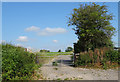
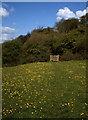
9
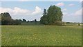
Path heading to Sherston
From Shallowbrooks Lane the path heading to Sherston
Image: © Shaun Ferguson
Taken: 11 May 2019
0.22 miles