Old Milestone by the B4040, Luckington Road, Sherston parish
Introduction
The photograph on this page of Old Milestone by the B4040, Luckington Road, Sherston parish by M Faherty as part of the Geograph project.
The Geograph project started in 2005 with the aim of publishing, organising and preserving representative images for every square kilometre of Great Britain, Ireland and the Isle of Man.

There are currently over 7.5m images from over 14,400 individuals and you can help contribute to the project by visiting https://www.geograph.org.uk
Old Milestone by the B4040, Luckington Road, Sherston parish
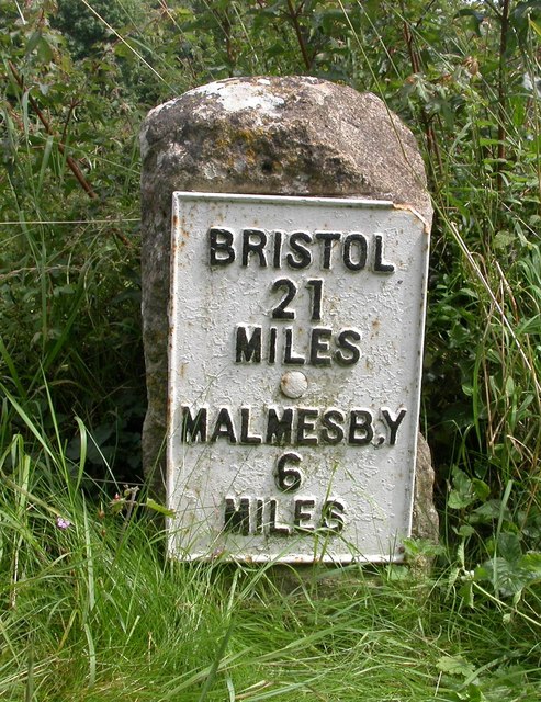
Image: © M Faherty Taken: 21 Jul 2007
Metal plate attached to stone post by the B4040, in parish of SHERSTON (NORTH WILTSHIRE District), Luckington Road; 150m West of Avon bridge, on the verge, on South side of road. Malmesbury iron plate, erected by the Faringdon to Acton Turville (2nd District) turnpike trust in the 19th century. Inscription reads:- BRISTOL 21 MILES MALMESB,Y 6 MILES Grade II listed. List Entry Number: 1356018 https://historicengland.org.uk/listing/the-list/list-entry/1356018 Milestone Society National ID: WI_MYBR06.
Images are licensed for reuse under creativecommons.org/licenses/by-sa/2.0
Image Location
Latitude
51.567151
Longitude
-2.219161