
IMAGES TAKEN NEAR TO
Dauntsey, CHIPPENHAM, SN15 4HL
Introduction
This page details the photographs taken nearby to SN15 4HL by members of the Geograph project.
The Geograph project started in 2005 with the aim of publishing, organising and preserving representative images for every square kilometre of Great Britain, Ireland and the Isle of Man.

There are currently over 7.5m images from over14,400 individuals and you can help contribute to the project by visiting https://www.geograph.org.uk
Image Map
Images are licensed for reuse under creativecommons.org/licenses/by-sa/2.0
Notes
- Clicking on the map will re-center to the selected point.
- The higher the marker number, the further away the image location is from the centre of the postcode.
Image Listing (8 Images Found)
Images are licensed for reuse under creativecommons.org/licenses/by-sa/2.0
Image
Details
Distance
1
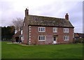
Good Monday's farm
Located about 500 metres south of the M4 motorway.
Image: © Roger Cornfoot
Taken: 12 Jan 2007
0.00 miles
2

Dauntsey cottage
One of the few surviving thatched cottages in the area.
Image: © Roger Cornfoot
Taken: 12 Jan 2007
0.07 miles
3
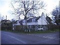
Old Sodom Lane
The junction with Dauntsey Green. This lane is now truncated by the M4 motorway.
Image: © Roger Cornfoot
Taken: 28 Dec 2006
0.14 miles
5

Wiltshire : Crop Field
A field with bales in.
Image: © Lewis Clarke
Taken: 28 Aug 2018
0.23 miles
6
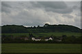
Wiltshire : Countryside Scenery
Looking out across the countryside from the M4 Motorway.
Image: © Lewis Clarke
Taken: 30 May 2017
0.23 miles
7
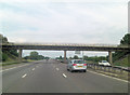
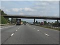
M4 roadbridge - lane from Dauntseys to Swallett Gate crosses
To the north of the motorway this is called Church Lane but to the south it is joined by Sodom Lane. Talk about the wrong side of the tracks!
Image: © Stuart Logan
Taken: 13 Jul 2011
0.24 miles
8
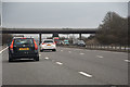
Wiltshire : M4 Motorway
The M4 Motorway between Junction 17 (Stanton St Quinton) and Junction 16 (Spittleborough).
Image: © Lewis Clarke
Taken: 23 Mar 2018
0.24 miles