
IMAGES TAKEN NEAR TO
Barton Close, CHIPPENHAM, SN15 4EZ
Introduction
This page details the photographs taken nearby to Barton Close, SN15 4EZ by members of the Geograph project.
The Geograph project started in 2005 with the aim of publishing, organising and preserving representative images for every square kilometre of Great Britain, Ireland and the Isle of Man.

There are currently over 7.5m images from over14,400 individuals and you can help contribute to the project by visiting https://www.geograph.org.uk
Image Map
Images are licensed for reuse under creativecommons.org/licenses/by-sa/2.0
Notes
- Clicking on the map will re-center to the selected point.
- The higher the marker number, the further away the image location is from the centre of the postcode.
Image Listing (34 Images Found)
Images are licensed for reuse under creativecommons.org/licenses/by-sa/2.0
Image
Details
Distance
1
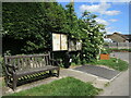
Bench in Bradenstoke
Alongside the noticeboards is a bench seat; it bears a plaque celebrating the Bradenstoke 90 carnival.
Image: © Neil Owen
Taken: 28 May 2022
0.06 miles
2
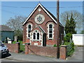
Primitive Methodist church, Bradenstoke
Image: © Jonathan Billinger
Taken: 6 May 2008
0.08 miles
3
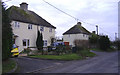
The east end of Bradenstoke.
These houses back onto RAF Lyneham.
Image: © Roger Cornfoot
Taken: 30 Dec 2006
0.11 miles
4
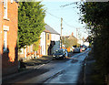
2010 : Bradenstoke village street
"Bradenstoke lies in the north west of the Lyneham and Bradenstoke parish, was originally the main area of the twinned settlement.
It was known as "Stoche" meaning settlement, and the area was well wooded, having lain within the boundaries of Braydon Forest. It was from the 12th century that the settlement was called Bradenstoke, and this was applied to the area surrounding Bradenstoke Priory, which was founded during that time."
The above was copied from: http://www.lynehamvillage.com/info/towns/bradenstoke.html
Image: © Maurice Pullin
Taken: 15 Nov 2010
0.11 miles
5
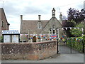
Bradenstoke Village Hall
Bedecked in bunting, ready for the Platinum Jubilee. The building is about 150 years old, being originally the school; it carried on as such until 1962 before closing. By 1969 the building had been converted as the village hall, and today has a long list of improvements and additions to accommodate all users.
Image: © Neil Owen
Taken: 28 May 2022
0.13 miles
6
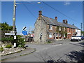
Road junction, Hollow Way, Bradenstoke
Cottages and road signs at the road junction.
Image: © Vieve Forward
Taken: 22 Apr 2017
0.17 miles
7
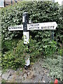
No through road, and no reading the sign
The signpost at the junction of Hollow Way and the road called Bradenstoke has become rather unkempt.
Image: © Neil Owen
Taken: 28 May 2022
0.18 miles
8

Central Cross, Bradenstroke
In the dead end of the village about 4 miles SW of Royal Wootton Basset. Used as a War Memorial since the 1920s.
Medieval steps, base and remains of shaft.
Grade II Listed Nᴼ 1022669 see https://historicengland.org.uk/listing/the-list/list-entry/1022669
Milestone Society National ID: WINW_LYN
Image: © Mr Red
Taken: 22 May 2026
0.20 miles
9
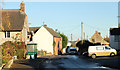
2010 : Hollow Way, Bradenstoke
The main street through the village.
Image: © Maurice Pullin
Taken: 15 Nov 2010
0.21 miles
10
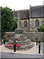
Bradenstoke cross and war memorial
The village preaching cross dates back to 1546-7 and used to stand a short distance from its present place in front of the church. In 1928 the village placed a bronze plaque on the stone to record the men who fell in the Great War, thus combining two historic artefacts. Approved restoration work was carried out in 2009 at a cost of £2,700. Grade II listed.
Image: © Neil Owen
Taken: 28 May 2022
0.21 miles