
IMAGES TAKEN NEAR TO
Field View, CHIPPENHAM, SN15 2QT
Introduction
This page details the photographs taken nearby to Field View, SN15 2QT by members of the Geograph project.
The Geograph project started in 2005 with the aim of publishing, organising and preserving representative images for every square kilometre of Great Britain, Ireland and the Isle of Man.

There are currently over 7.5m images from over14,400 individuals and you can help contribute to the project by visiting https://www.geograph.org.uk
Image Map
Images are licensed for reuse under creativecommons.org/licenses/by-sa/2.0
Notes
- Clicking on the map will re-center to the selected point.
- The higher the marker number, the further away the image location is from the centre of the postcode.
Image Listing (110 Images Found)
Images are licensed for reuse under creativecommons.org/licenses/by-sa/2.0
Image
Details
Distance
1
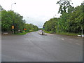
The road to the east
The A4 road seen from its junction with Gladstone Road. This was, of course, the main road between Bristol and London before the construction of the M4 motorway. It is difficult to conceive of the volume of traffic that now thunders along the M4 on this quiet road in the centre of a large town.
Image: © Michael Dibb
Taken: 24 Jun 2012
0.08 miles
2
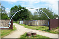
Millennium Wall, Chippenham
Along a riverside cycleway.
Nothing much on the web about it.
Another of the many commemorative things that got done in year 2000.
Image: © Des Blenkinsopp
Taken: 2 Jun 2021
0.10 miles
3
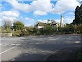
Burnt-out house on Rowden Hill
This once substantial house in a well-to-do suburb of Chippenham was set alight by a former owner in August 2011 and gutted. Plans are proposed to demolish the remains of it and develop the site https://www.swindonadvertiser.co.uk/news/23377892.uncertainty-future-derelict-chippenham-house-rowden-hill/ but as yet nothing has happened. Taken from Erleigh Drive on the other side of the A4.
Image: © HelenK
Taken: 10 Apr 2023
0.11 miles
4

Flooded path
Following heavy rain the previous evening, the riverside path is flooded as it passes under the bridge carrying Gladstone Road.
Image: © Michael Dibb
Taken: 24 Jun 2012
0.11 miles
5
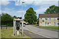
Phone Box, Charter Road
A bit worn out looking, but still there. Probably not for long though. BT are planning to remove it, according to the blue notice inside.
Image: © Des Blenkinsopp
Taken: 2 Jun 2021
0.11 miles
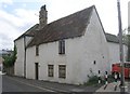
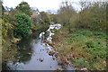
8
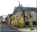
Hygrade Food Products - Westmead Lane
Image: © Betty Longbottom
Taken: 25 Aug 2008
0.13 miles
9
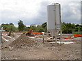
Out with the food, in with the homes
This is a view along Westmead Lane, now rather different today. Not so long ago it was a large industrial site, mainly occupied by Hygrade Foods (a meat products company), but they were sold to a Danish firm who consequently moved their operations elsewhere and left the area derelict. The local council have now approved the site to become a modern residential opportunity - but first the old factories have had to come down. See Image] for another view.
Image: © Neil Owen
Taken: 30 Jun 2014
0.13 miles
10
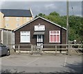
St John's Ambulance HQ - Westmead Lane
Image: © Betty Longbottom
Taken: 25 Aug 2008
0.14 miles