
IMAGES TAKEN NEAR TO
Netherstreet, CHIPPENHAM, SN15 2LJ
Introduction
This page details the photographs taken nearby to Netherstreet, SN15 2LJ by members of the Geograph project.
The Geograph project started in 2005 with the aim of publishing, organising and preserving representative images for every square kilometre of Great Britain, Ireland and the Isle of Man.

There are currently over 7.5m images from over14,400 individuals and you can help contribute to the project by visiting https://www.geograph.org.uk
Image Map
Images are licensed for reuse under creativecommons.org/licenses/by-sa/2.0
Notes
- Clicking on the map will re-center to the selected point.
- The higher the marker number, the further away the image location is from the centre of the postcode.
Image Listing (27 Images Found)
Images are licensed for reuse under creativecommons.org/licenses/by-sa/2.0
Image
Details
Distance
1

St. Edith?s Marsh: postbox № SN15 221 and redundant phone box
Although the telephone box remains in place, the apparatus has been removed so it's now a purely cosmetic feature of the village.
The postbox is emptied finally at 4pm on weekdays and at 8:15 on Saturday mornings.
Image: © Chris Downer
Taken: 4 Apr 2009
0.02 miles
2
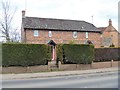
Houses at St Edith's Marsh
The houses have interesting small diamond shaped stair windows.
Image: © Michael Dibb
Taken: 26 Mar 2018
0.03 miles
3
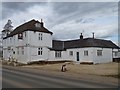
The Coconut Restaurant
Until recently (2015) this building was The Oliver Cromwell public house but it is now an Indian Restaurant. Dated 1698, the building is listed, grade II, with details at: https://www.historicengland.org.uk/listing/the-list/list-entry/1365578
Image: © Michael Dibb
Taken: 26 Mar 2018
0.05 miles
4
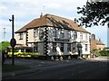
The Oliver Cromwell, Netherstreet
Formerly called the Bell Inn, the Oliver Cromwell dates from 1698. The current name was presumably chosen with a mind to associations with the nearby civil war battle of Roundway Down Image
Image: © Doug Lee
Taken: 11 Jun 2006
0.07 miles
5
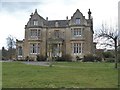
St Edith's House
This lovely Jacobean style country house was built circa 1865. Listed, grade II, with details at: https://www.historicengland.org.uk/listing/the-list/list-entry/1033898
Image: © Michael Dibb
Taken: 26 Mar 2018
0.07 miles
6
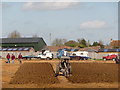
St. Edith?s Marsh: a ploughman at work
This chap is competing in the final of the Inter-Counties Ploughing Championship. The same field will be used tomorrow for some other match, I noticed on a sign as I went past.
Image: © Chris Downer
Taken: 4 Apr 2009
0.07 miles
7
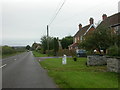
Milepost, St Edith's Marsh, Bromham
A well preserved milepost here on a verge/in a front garden. The post has a gabled top, bevelled front, and is set onto a stone. Distances are given to Chippenham (7), Calne (5) and Devizes (3), and the maker's name is at the base, Burt Devizes, a well-known iron foundry.
Image: © Mike Faherty
Taken: 26 Oct 2008
0.07 miles
8
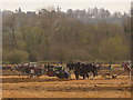
St. Edith?s Marsh: ploughing competition
The Inter-Counties Ploughing final in progress at St. Edith's Marsh, Bromham – horsepower competing against horse power!
Image: © Chris Downer
Taken: 4 Apr 2009
0.08 miles
9

Old Milestone by the A342, Saint Edith's Marsh, Bromham parish
Metal plate attached to stone post by the A342, in parish of BROMHAM (KENNET District), Saint Edith's Marsh, South side of hamlet, outside No. 176, Hill View, on open lawn in front of No. 176, on West side of road. Burt iron casting, erected by the Devizes (consolidated) turnpike trust in the 19th century.
Inscription reads:-
: CHIPPENm / 7 : : DEVIZES / 3 : : CALNE / 5 :
Maker:-
: BURT / DEVIZES :
Grade II listed.
List Entry Number: 1365599 https://historicengland.org.uk/listing/the-list/list-entry/1365599
Milestone Society National ID: WI_DZCP03.
Image: © M Faherty
Taken: 26 Oct 2008
0.09 miles
10
![3 miles to Devizes [1]](https://s0.geograph.org.uk/geophotos/05/71/58/5715800_33b3ed16_120x120.jpg)
3 miles to Devizes [1]
The early 19th century milestone is alongside the A342 road. It reads Devizes 3; Chippenham 7; Calne 5: Listed, grade II, with details at https://historicengland.org.uk/listing/the-list/list-entry/1365599
Image: © Michael Dibb
Taken: 21 Mar 2018
0.09 miles