IMAGES TAKEN NEAR TO
Greystones, CHIPPENHAM, SN15 2JT
Introduction
This page details the photographs taken nearby to Greystones, SN15 2JT by members of the Geograph project.
The Geograph project started in 2005 with the aim of publishing, organising and preserving representative images for every square kilometre of Great Britain, Ireland and the Isle of Man.

There are currently over 7.5m images from over14,400 individuals and you can help contribute to the project by visiting https://www.geograph.org.uk
Image Map
Images are licensed for reuse under creativecommons.org/licenses/by-sa/2.0
Notes
- Clicking on the map will re-center to the selected point.
- The higher the marker number, the further away the image location is from the centre of the postcode.
Image Listing (4 Images Found)
Images are licensed for reuse under creativecommons.org/licenses/by-sa/2.0
Image
Details
Distance
1
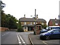
Street Scene, Bromham
This area of the village has more modern housing with a K6 type telephone box.
Image: © Maigheach-gheal
Taken: 3 Nov 2009
0.12 miles
2
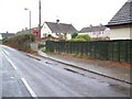
2009 : East from the A3102 near Bromham
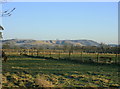
At the start of a footpath between the A3102 and Bromham. Traffic on the A342 can be seen.
The range of hills in the distance, on the edge of the Marlborough Downs, reading from right to left are Roundway, then Oliver's Castle Image with a few trees on top, and Beacon Hill.
Between the last two there an unusual bit of corrugated hillside, an explanation for which can be found in Image]
Image] gives a similar view of these hills from a different direction.
Image: © Maurice Pullin
Taken: 6 Jan 2009
0.21 miles
3
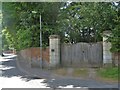
Battle House entrance
The entrance gates to the grounds of Battle House, a grade II* listed property. The nice "keep the peasants out" wall prevented a glimpse of the house.
Image: © Michael Dibb
Taken: 18 May 2018
0.23 miles