
IMAGES TAKEN NEAR TO
Durlett, CHIPPENHAM, SN15 2HY
Introduction
This page details the photographs taken nearby to Durlett, SN15 2HY by members of the Geograph project.
The Geograph project started in 2005 with the aim of publishing, organising and preserving representative images for every square kilometre of Great Britain, Ireland and the Isle of Man.

There are currently over 7.5m images from over14,400 individuals and you can help contribute to the project by visiting https://www.geograph.org.uk
Image Map
Images are licensed for reuse under creativecommons.org/licenses/by-sa/2.0
Notes
- Clicking on the map will re-center to the selected point.
- The higher the marker number, the further away the image location is from the centre of the postcode.
Image Listing (16 Images Found)
Images are licensed for reuse under creativecommons.org/licenses/by-sa/2.0
Image
Details
Distance
1
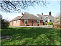
Rural bungalows
These attractive properties are located alongside Durlett Road.
Image: © Michael Dibb
Taken: 21 Mar 2018
0.00 miles
2
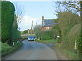
2009 : Durlett Road looking north
Durlett Road forms a useful link between Bromham and Sells Green.
Image: © Maurice Pullin
Taken: 20 Jan 2009
0.05 miles
3
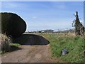
Path leaves the road
The footpath leaves Durlett Road and meets/joins several other paths.
Image: © Michael Dibb
Taken: 21 Mar 2018
0.05 miles
4
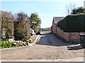
Start of bridleway
From Durlett Road, the bridleway runs to the A342 road at Rowdeford. The track leads to Clenche Farm.
Image: © Michael Dibb
Taken: 21 Mar 2018
0.06 miles
5
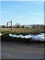
Old post, new sign
The old post has been reused and now supports a new sign. Oliver's Castle is prominent in the distance.
Image: © Michael Dibb
Taken: 21 Mar 2018
0.12 miles
6
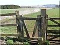
Unusual stile
A somewhat unusual stile with the top bar swinging to open and close.
Image: © Michael Dibb
Taken: 21 Mar 2018
0.13 miles
7
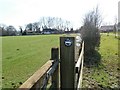
Old sign
An old-style 'public bridleway' sign on the gatepost. Clenche Farm is seen in the distance.
Image: © Michael Dibb
Taken: 21 Mar 2018
0.13 miles
8
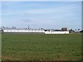
Poultry houses
There are 14 poultry houses on the site, partly hidden behind the plastic tunnel. Seen from the bridleway.
Image: © Michael Dibb
Taken: 21 Mar 2018
0.14 miles
9
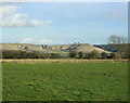
2009 : Pasture east of Durlett Road
The cattle have been moved inside, but only recently. Sheep are usually left out, they have thick coats to protect them and only need moving if they are on high ground.
In the background we have a grand view of Oliver's Castle, Image the hill with the trees on top. When you are too far away to see the trees the crinkly hillside to the left of it is a good landmark.
Image: © Maurice Pullin
Taken: 20 Jan 2009
0.14 miles
10
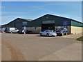
Industrial units
Some industrial units occupy the corner of New Road and Hawkstreet.
Image: © Michael Dibb
Taken: 21 Mar 2018
0.14 miles