
IMAGES TAKEN NEAR TO
Jockey Lane, CHIPPENHAM, SN15 2EZ
Introduction
This page details the photographs taken nearby to Jockey Lane, SN15 2EZ by members of the Geograph project.
The Geograph project started in 2005 with the aim of publishing, organising and preserving representative images for every square kilometre of Great Britain, Ireland and the Isle of Man.

There are currently over 7.5m images from over14,400 individuals and you can help contribute to the project by visiting https://www.geograph.org.uk
Image Map
Images are licensed for reuse under creativecommons.org/licenses/by-sa/2.0
Notes
- Clicking on the map will re-center to the selected point.
- The higher the marker number, the further away the image location is from the centre of the postcode.
Image Listing (119 Images Found)
Images are licensed for reuse under creativecommons.org/licenses/by-sa/2.0
Image
Details
Distance
1
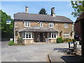
The Greyhound
This delightful mid 19th century inn is listed, grade II, with details at: https://www.historicengland.org.uk/listing/the-list/list-entry/1365571
Image: © Michael Dibb
Taken: 18 May 2018
0.04 miles
3
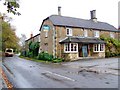
The Greyhound Inn, Bromham
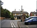
Built in the mid 19th century the Greyhound Inn is Grade II listed.
Image: © Maigheach-gheal
Taken: 3 Nov 2009
0.04 miles
4
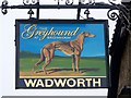
Sign for the Greyhound at Bromham
The heraldic reference of this name is to the Dukes of Newcastle, owners of land and property in many parts of the country. Usually the greyhound itself is shown. It has also been know as a gazehound, because it relies more on sight than smell. The greyhound was formerly used in the chase, but is now mainly associated with greyhound racing, or 'greycing'. The 'grey' of greyhound has nothing to do with the colour, but is a different word of uncertain origin.
Image: © Maigheach-gheal
Taken: 3 Nov 2009
0.05 miles
5
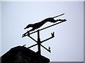
Greyhound weather vane, Bromham
The weather vane is to be found on the Greyhound Inn.
Image: © Maigheach-gheal
Taken: 3 Nov 2009
0.05 miles
6
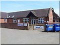
Primary school
St Nicholas Church of England primary school.
Image: © Michael Dibb
Taken: 18 May 2018
0.06 miles
7
![Church House [1]](https://s3.geograph.org.uk/geophotos/05/78/54/5785407_221cee07_120x120.jpg)
Church House [1]
This delightful 15th century timber-framed house has a smaller 17th century extension. The fine shopfront with bow window is early 19th century. Listed, grade II, with details at: https://www.historicengland.org.uk/listing/the-list/list-entry/1200486
Image: © Michael Dibb
Taken: 18 May 2018
0.07 miles
8
![Church House [2]](https://s0.geograph.org.uk/geophotos/05/78/54/5785412_2ca96ae5_120x120.jpg)
Church House [2]
This delightful 15th century timber-framed house has a smaller 17th century extension. The fine shopfront with bow window is early 19th century. Listed, grade II, with details at: https://www.historicengland.org.uk/listing/the-list/list-entry/1200486
Image: © Michael Dibb
Taken: 18 May 2018
0.07 miles
9
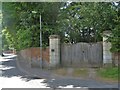
Battle House entrance
The entrance gates to the grounds of Battle House, a grade II* listed property. The nice "keep the peasants out" wall prevented a glimpse of the house.
Image: © Michael Dibb
Taken: 18 May 2018
0.07 miles
10
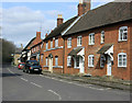
2010 : Old houses on High Street, Bromham
A lively village website at: http://www.bromham.org.uk/category/News.aspx a little short on village history perhaps, but here is a snippet from: http://www.wiltshire.gov.uk/community/getcom.php?id=37
"There is little evidence of Saxon settlement here, although finds such as a stirrup mount and a strap end have been made. Saxon building and utensils were of wood and this has disappeared but we know that there was a later Saxon settlement as it is recorded in the Domesday Book. The fact that there was also a priest, and therefore a church, would indicate that this was a community of some standing. It is most likely that there was continuous occupation from Romano British times.
In 1086 the Domesday Book gives us some idea of the size of the village. It was held by the king and had sufficient land for 10 plough teams. Modern interpretation of the numbers recorded would give a population of between 220 and 260. There were also 2 mills, meadowland, pasture and a small wood. Around 1087 Bromham was given to Battle Abbey, founded by William I to give thanks for his victory, and it retained it until the dissolution in 1538.
There is much evidence of medieval settlement here, the church, house sites, earth-works, a deer park and more iron working. A medieval village also developed at Chittoe with its own mill and chapel of ease. By the early 14th century the chief animal husbandry was sheep and pigs, with much land (about 336 acres) used for growing cereals. Weaving was most likely to have been well established by this time. The late 15th century saw the building of Porch House, originally the Chantry, for the chantry priest of the Tocates chapel (1492)."
Image: © Maurice Pullin
Taken: 21 Mar 2010
0.08 miles