
IMAGES TAKEN NEAR TO
Chittoe Heath, CHIPPENHAM, SN15 2EJ
Introduction
This page details the photographs taken nearby to Chittoe Heath, SN15 2EJ by members of the Geograph project.
The Geograph project started in 2005 with the aim of publishing, organising and preserving representative images for every square kilometre of Great Britain, Ireland and the Isle of Man.

There are currently over 7.5m images from over14,400 individuals and you can help contribute to the project by visiting https://www.geograph.org.uk
Image Map
Images are licensed for reuse under creativecommons.org/licenses/by-sa/2.0
Notes
- Clicking on the map will re-center to the selected point.
- The higher the marker number, the further away the image location is from the centre of the postcode.
Image Listing (4 Images Found)
Images are licensed for reuse under creativecommons.org/licenses/by-sa/2.0
Image
Details
Distance
1
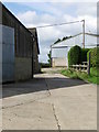
Footpath, Chittoe
The footpath takes walkers through the farm buildings of Manor Farm and across pasture to Nonsuch Nurseries.
Image: © Maigheach-gheal
Taken: 27 Aug 2010
0.13 miles
2
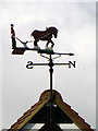
Weather vane, Manor Farm
As long as humans have farmed the land, sailed the seas and contemplated their place in nature, the wind has played a key role in their speculations. It was interpreting the wind's changing direction that helped our ancestors predict the coming weather and survive.
Image: © Maigheach-gheal
Taken: 27 Aug 2010
0.14 miles
3
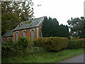
Methodist Chapel, Chittoe Heath
A simple rectangular chapel with rear extension, built of red brick with yellow detail. The front is partially obscured by yew trees. A label on the front proclaims "Primitive Methodist 1882".
Image: © Mike Faherty
Taken: 26 Oct 2008
0.17 miles
4
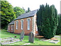
Primitive Methodist Chapel, Chittoe
The chapel has a date stone of 1882.
Image: © Maigheach-gheal
Taken: 27 Aug 2010
0.19 miles