
IMAGES TAKEN NEAR TO
Ridings Mead, CHIPPENHAM, SN15 1PQ
Introduction
This page details the photographs taken nearby to Ridings Mead, SN15 1PQ by members of the Geograph project.
The Geograph project started in 2005 with the aim of publishing, organising and preserving representative images for every square kilometre of Great Britain, Ireland and the Isle of Man.

There are currently over 7.5m images from over14,400 individuals and you can help contribute to the project by visiting https://www.geograph.org.uk
Image Map
Images are licensed for reuse under creativecommons.org/licenses/by-sa/2.0
Notes
- Clicking on the map will re-center to the selected point.
- The higher the marker number, the further away the image location is from the centre of the postcode.
Image Listing (18 Images Found)
Images are licensed for reuse under creativecommons.org/licenses/by-sa/2.0
Image
Details
Distance
1
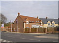
A new addition
Some recently built properties opposite Barnes Road.
Image: © Neil Owen
Taken: 29 Feb 2012
0.06 miles
2
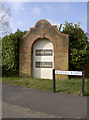
Barnes Road, Chippenham
This new development in the Hardenhuish area has a somewhat ornate sign to denote it.
Image: © Neil Owen
Taken: 29 Feb 2012
0.07 miles
3
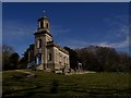
Hardenhuish Church
Designed by John Wood.
Tomb of 19th century economist David Ricardo at the right.
Image: © tristan forward
Taken: 21 Feb 2009
0.13 miles
4
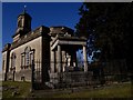
Tomb of 19th century economist David Ricardo
Stands by the south-east corner of Hardenhuish Church.
Image: © tristan forward
Taken: 21 Feb 2009
0.13 miles
5
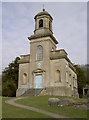
St Nicholas church, Hardenhuish
This distinctive church, on a hill overlooking the school, was built in 1779. Its classical Georgian style is the result of architect John Wood (the younger); Wood is renowned for his designs of The Royal Crescent and The Circus in Bath. Also of note is the Ricardo Monument - containing the tombs of nine of the family from whom David (famed for his immense financial standing in the Stock Exchange) came from.
Image: © Neil Owen
Taken: 29 Feb 2012
0.16 miles
6
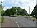
Roundabout on Stainers Way
Where Barnes Road goes off to the left.
Image: © Stephen Craven
Taken: 13 Jul 2022
0.22 miles
7
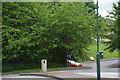
Chippenham : Stainer's Way
A roundabout on Stainer's Way.
Image: © Lewis Clarke
Taken: 30 May 2017
0.22 miles
8
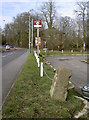
Leaning over
The old milestone on the Malmesbury Road is now not true to vertical. See Image] for a closer view.
Image: © Neil Owen
Taken: 29 Feb 2012
0.22 miles
9
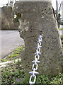
No longer level
A curious 1GL boltmark in a milestone on the Malmesbury Road - now shifted from its original position. Perhaps that may have something to do with the bolt not being aligned with the datum cut? See Roger Templeman's pic Image] for greater clarity or Image] for a wider view.
Image: © Neil Owen
Taken: 29 Feb 2012
0.22 miles
10
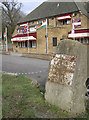
Old milestone on Malmesbury Road
On the B4158 is an old milestone, looking a little neglected. It still just about says one mile to Chippenham. However, it is also the place to find an unusual benchmark (see Image] ) - unusual not only because it is a 1GL boltmark, but also because the bolt is not aligned with the datum line. Sadly, the milestone's neglect has seen it topple slightly off its original level, rendering accurate levelling difficult (see Image]).
Image: © Neil Owen
Taken: 29 Feb 2012
0.22 miles