
IMAGES TAKEN NEAR TO
Hardenhuish Avenue, CHIPPENHAM, SN15 1NJ
Introduction
This page details the photographs taken nearby to Hardenhuish Avenue, SN15 1NJ by members of the Geograph project.
The Geograph project started in 2005 with the aim of publishing, organising and preserving representative images for every square kilometre of Great Britain, Ireland and the Isle of Man.

There are currently over 7.5m images from over14,400 individuals and you can help contribute to the project by visiting https://www.geograph.org.uk
Image Map
Images are licensed for reuse under creativecommons.org/licenses/by-sa/2.0
Notes
- Clicking on the map will re-center to the selected point.
- The higher the marker number, the further away the image location is from the centre of the postcode.
Image Listing (56 Images Found)
Images are licensed for reuse under creativecommons.org/licenses/by-sa/2.0
Image
Details
Distance
1
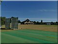
Chippenham Cricket Club
The ground is off Bristol Road.
Image: © Stephen Craven
Taken: 14 Jul 2022
0.05 miles
2
Chippenham Cricket Club - Bristol Road
Image: © Betty Longbottom
Taken: 29 Aug 2008
0.08 miles
3
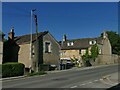
Oak Lodge, Bristol Road, Chippenham
Dating from the mid 18th century with later alterations, and listed grade II (list entry 1268152). For the stable block to the left, see Image
Image: © Stephen Craven
Taken: 14 Jul 2022
0.08 miles
4
Chippenham Tennis Club - Bristol Road
Image: © Betty Longbottom
Taken: 29 Aug 2008
0.09 miles
6
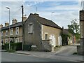
Former stables at Oak Lodge
Dating from the mid 19th century and listed grade II (list entry 1268153), this is a former stable building with arched carriage entrance and hay loft above.
Image: © Stephen Craven
Taken: 13 Jul 2022
0.09 miles
7
Car park for Chippenham Town Football Club
On Bristol Road
Image: © Eirian Evans
Taken: 16 Feb 2011
0.10 miles
8
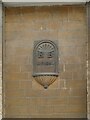
Terraced Houses, Marshfield Road, Chippenham (Detail)
Above an archway in the middle of the terrace is a datestone (AD 1854) with the initials RB, which the grade II listing says stands for Rowland Brotherhood, who had the houses built for workers at his railway works in Foundry Lane. For context see Image The listing also gives the date as 1858 but that may be a completion date, 1854 being the commencement.
Image: © Stephen Craven
Taken: 13 Jul 2022
0.11 miles
9
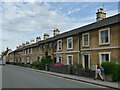
Terraced Houses, Marshfield Road, Chippenham
The terrace of 15 cottages was built in 1858 for railway workers, and is listed grade II (list entry 1268003). To the left of the second house from the right is a datestone above an archway Image
Image: © Stephen Craven
Taken: 13 Jul 2022
0.11 miles
10
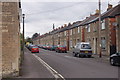
Parkfields, Chippenham
Maybe now called Parkfields Court. A row of houses behind the old Chippenham to Bristol Road.
Image: © richard noyes
Taken: 22 Aug 2009
0.12 miles