
IMAGES TAKEN NEAR TO
Rowlands Way, Langley Park, CHIPPENHAM, SN15 1GF
Introduction
This page details the photographs taken nearby to Rowlands Way, Langley Park, SN15 1GF by members of the Geograph project.
The Geograph project started in 2005 with the aim of publishing, organising and preserving representative images for every square kilometre of Great Britain, Ireland and the Isle of Man.

There are currently over 7.5m images from over14,400 individuals and you can help contribute to the project by visiting https://www.geograph.org.uk
Image Map
Images are licensed for reuse under creativecommons.org/licenses/by-sa/2.0
Notes
- Clicking on the map will re-center to the selected point.
- The higher the marker number, the further away the image location is from the centre of the postcode.
Image Listing (24 Images Found)
Images are licensed for reuse under creativecommons.org/licenses/by-sa/2.0
Image
Details
Distance
1
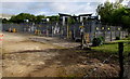
Large electricity substation in Chippenham
Set back from Cocklebury Road near the Wiltshire & Swindon History Centre. http://www.geograph.org.uk/photo/4470571
Image: © Jaggery
Taken: 9 May 2015
0.15 miles
2
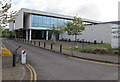
Wiltshire & Swindon History Centre, Chippenham
Set back from the north side of Cocklebury Road. Their website states that the History Centre brings the archaeology, archive, buildings record, conservation and museum advisory services together with the county local studies library to create a centre whose sum is much more than that of its parts. If you are researching your ancestors or trying to find out more about a town or parish in Wiltshire or Swindon, or if you want professional advice and guidance on other heritage issues, this is the ideal place to visit or contact.
Image: © Jaggery
Taken: 9 May 2015
0.17 miles
3
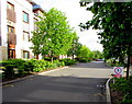
Dead slow - pedestrians ahead, Great Mead, Chippenham
Below a 5mph maximum speed limit sign, text shows DEAD SLOW PEDESTRIANS AHEAD.
This photo's title is my interpretation of the message - others are possible, though unlikely.
Image: © Jaggery
Taken: 9 May 2015
0.17 miles
5
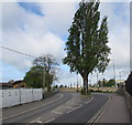
Tree in the middle of a Chippenham road
In the middle of Cocklebury Road, at a bend.
Image: © Jaggery
Taken: 9 May 2015
0.19 miles
6

Wiltshire & Swindon History Centre name sign, Chippenham
The sign shows that the History Centre http://www.geograph.org.uk/photo/4470571 is a joint Swindon Borough Council and Wiltshire Council site.
Image: © Jaggery
Taken: 9 May 2015
0.19 miles
7
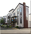
Great Mead, Chippenham
Recently-built housing on the north side of Cocklebury Road, viewed in early May 2015.
Image: © Jaggery
Taken: 9 May 2015
0.20 miles
9
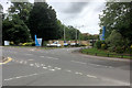
Entrance to Langley Park, Chippenham
Langley Park was originally owned by Westinghouse Brakes and Signals from approximately 1935 to 2002. It is now a commercial business park whose tenants include Siemens and Avon and Wiltshire NHS http://langleyparkchippenham.com/ .
Image: © David Dixon
Taken: 16 Jun 2017
0.20 miles
10
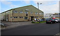
Wiltshire College G Block, Chippenham
Viewed across Cocklebury Road. Situated in the NE corner of the Wiltshire College campus,
G Block is the location of Godown Sports Centre and Aspire Hair & Beauty Salons.
Image: © Jaggery
Taken: 9 May 2015
0.20 miles