
IMAGES TAKEN NEAR TO
Tormarton Road, CHIPPENHAM, SN14 8NW
Introduction
This page details the photographs taken nearby to Tormarton Road, SN14 8NW by members of the Geograph project.
The Geograph project started in 2005 with the aim of publishing, organising and preserving representative images for every square kilometre of Great Britain, Ireland and the Isle of Man.

There are currently over 7.5m images from over14,400 individuals and you can help contribute to the project by visiting https://www.geograph.org.uk
Image Map
Images are licensed for reuse under creativecommons.org/licenses/by-sa/2.0
Notes
- Clicking on the map will re-center to the selected point.
- The higher the marker number, the further away the image location is from the centre of the postcode.
Image Listing (103 Images Found)
Images are licensed for reuse under creativecommons.org/licenses/by-sa/2.0
Image
Details
Distance
1
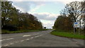
A420 Marshfield bypass
Looking west from the junction with Tormarton Road.
Image: © Jonathan Billinger
Taken: 19 Nov 2013
0.03 miles
2
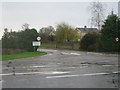
Marshfield from the bypass
This bypass doesn't feature on the 1940 OS map
Image: © Stephen Bashford
Taken: 3 Dec 2005
0.06 miles
3

A new place for the Post Office
Marshfield's latest incarnation of the village Post Office on Tormarton Road. It appears to be a varied facility with a cafe seating too.
Image: © Neil Owen
Taken: 23 Jul 2022
0.10 miles
4

Marshfield Cemetery
Marshfield Cemetery
Image: © Stephen Bashford
Taken: 3 Dec 2005
0.10 miles
5
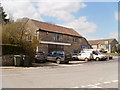
Marshfield, Central Garage
On Hay Street; take away the vehicles & price sign, and you could be back in time by many decades.
Image: © Mike Faherty
Taken: 20 Apr 2010
0.13 miles
6
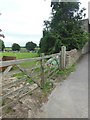
Marshfield cemetery
Located just outside the village, and now separated from it by the A420.
Image: © HelenK
Taken: 31 May 2016
0.13 miles
7
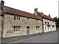
Houses on Hay Street
The eastern extension of Marshfield High Street.
Image: © Oliver Dixon
Taken: 30 Jun 2017
0.14 miles
8
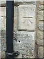
Benchmark on Hay Street
A newer benchmark on a house on Hay Street, Marshfield. It is from the post-war period and is listed in the Benchmark Database: https://www.bench-marks.org.uk/bm160748 . See Image] for a wider view.
Image: © Neil Owen
Taken: 23 Jul 2022
0.14 miles
9
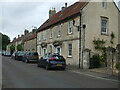
Along Hay Street
A look along one of Marshfield's primary roads. A benchmark can be discovered by the drainpipe - see Image
Image: © Neil Owen
Taken: 23 Jul 2022
0.14 miles
10
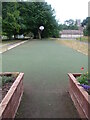
Many leisure uses
A long, artificial surface strip outside the community centre seems to have once been a single bowling lane. At the far end is a basketball hoop (without a counterpart) and the near end now has planters.
Image: © Neil Owen
Taken: 23 Jul 2022
0.15 miles