
IMAGES TAKEN NEAR TO
Market Place, CHIPPENHAM, SN14 8NR
Introduction
This page details the photographs taken nearby to Market Place, SN14 8NR by members of the Geograph project.
The Geograph project started in 2005 with the aim of publishing, organising and preserving representative images for every square kilometre of Great Britain, Ireland and the Isle of Man.

There are currently over 7.5m images from over14,400 individuals and you can help contribute to the project by visiting https://www.geograph.org.uk
Image Map
Images are licensed for reuse under creativecommons.org/licenses/by-sa/2.0
Notes
- Clicking on the map will re-center to the selected point.
- The higher the marker number, the further away the image location is from the centre of the postcode.
Image Listing (119 Images Found)
Images are licensed for reuse under creativecommons.org/licenses/by-sa/2.0
Image
Details
Distance
1
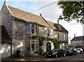
The Old Inn
The Old Inn served the important coaching route through the Cotswolds from the early eighteenth century, but is today a private residence. Note the large ironwork for the sign projecting from the wall; Grade II listed.
Image: © Neil Owen
Taken: 18 Oct 2016
0.02 miles
2
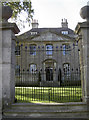
Marshfield House
A late seventeenth century house, with some alterations of 1730, occupying a prominent spot close to the church of St Mary's. Grade II* listed.
Image: © Neil Owen
Taken: 18 Oct 2016
0.02 miles
3
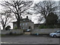
Marshfield House, Marshfield
Previously known as The Vicarage. The last vicar to live here was Rev John Miskin Prior. Following his departure from the village in 1982, a new vicarage was built on land in Church Lane, and the old vicarage was sold as a private residence.
Image: © Eirian Evans
Taken: 1 Feb 2016
0.03 miles

5
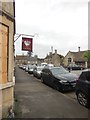
High St, Marshfield
The Crown https://www.closedpubs.co.uk/gloucestershire/marshfield_crown.html is currently closed and boarded up (a history of its flourishing and decline can be found here http://www.marshfieldparish.org.uk/wp/marshfield-history/crown.htm ); another pub, the Catherine Wheel http://www.thecatherinewheel.co.uk/ is further down the road on the right. The nearer building on the right is the former school. St Mary's Church, just visible at the far end, was at one time the venue for concerts by the Marshfield Bach Singers, conducted by Eric Roseberry.
Image: © HelenK
Taken: 31 May 2016
0.04 miles
6
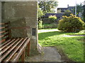
Flush bracket on St Mary's church
A flush bracket, as listed in the Benchmark Database: http://www.bench-marks.org.uk/bm18862 , set in St Mary's church, Marshfield. It was installed in the twentieth century and succeeded a previous century cutmark just a few feet away - see Image] for the latter or Image] for a wider view.
Image: © Neil Owen
Taken: 18 Oct 2016
0.04 miles
7
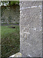
Cancelled benchmark
This cutmark was set into St Mary's west end buttressing in the nineteenth century. However, it has since been cancelled (the two diagonals above the datum line indicate this) and replaced by a flush bracket not so far away. See Image] for a look at the tower base and Image] for the newer mark.
Image: © Neil Owen
Taken: 18 Oct 2016
0.04 miles
8
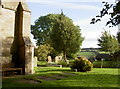
St Mary's tower and graveyard
A flush bracket has been installed into the buttressing of the tower - see Image
Image: © Neil Owen
Taken: 18 Oct 2016
0.04 miles
9
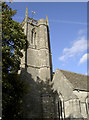
St Mary's tower
The little parish church was rebuilt in around 1470 in the Perpendicular Style. Up to this time it was dedicated to St Nicholas, but with the Monks of Tewkesbury Abbey setting about replacing a central tower with the present west one, it became St Mary's. Grade I listed.
Image: © Neil Owen
Taken: 18 Oct 2016
0.04 miles
10
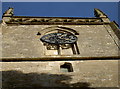
St Mary's clock
The church tower has a clock but looking up reveals the odd angles and levels.
Image: © Neil Owen
Taken: 18 Oct 2016
0.04 miles