High St, Marshfield
Introduction
The photograph on this page of High St, Marshfield by HelenK as part of the Geograph project.
The Geograph project started in 2005 with the aim of publishing, organising and preserving representative images for every square kilometre of Great Britain, Ireland and the Isle of Man.

There are currently over 7.5m images from over 14,400 individuals and you can help contribute to the project by visiting https://www.geograph.org.uk
High St, Marshfield
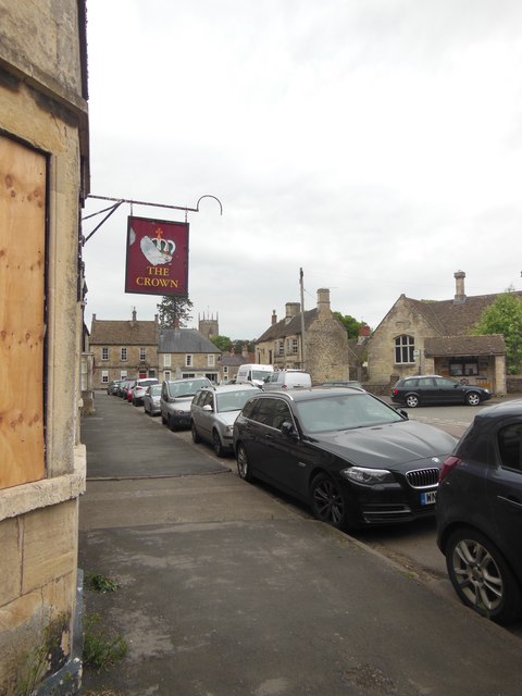
Image: © HelenK Taken: 31 May 2016
The Crown https://www.closedpubs.co.uk/gloucestershire/marshfield_crown.html is currently closed and boarded up (a history of its flourishing and decline can be found here http://www.marshfieldparish.org.uk/wp/marshfield-history/crown.htm ); another pub, the Catherine Wheel http://www.thecatherinewheel.co.uk/ is further down the road on the right. The nearer building on the right is the former school. St Mary's Church, just visible at the far end, was at one time the venue for concerts by the Marshfield Bach Singers, conducted by Eric Roseberry.
Images are licensed for reuse under creativecommons.org/licenses/by-sa/2.0
Image Location
Latitude
51.461847
Longitude
-2.316047