
IMAGES TAKEN NEAR TO
Coopers Meadow, CHIPPENHAM, SN14 7PZ
Introduction
This page details the photographs taken nearby to Coopers Meadow, SN14 7PZ by members of the Geograph project.
The Geograph project started in 2005 with the aim of publishing, organising and preserving representative images for every square kilometre of Great Britain, Ireland and the Isle of Man.

There are currently over 7.5m images from over14,400 individuals and you can help contribute to the project by visiting https://www.geograph.org.uk
Image Map
Images are licensed for reuse under creativecommons.org/licenses/by-sa/2.0
Notes
- Clicking on the map will re-center to the selected point.
- The higher the marker number, the further away the image location is from the centre of the postcode.
Image Listing (62 Images Found)
Images are licensed for reuse under creativecommons.org/licenses/by-sa/2.0
Image
Details
Distance
1
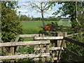
A rustic path
The footpath to the field is regulated by a wooden gate that is a change from the usual metal versions.
Image: © Neil Owen
Taken: 29 Apr 2019
0.05 miles
2
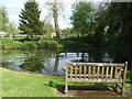
The Halfpenny Pond on Grove Lane
A small but delightful pond, it appears to be a fairly modern feature. It is certainly nice enough to spend a few moments resting and contemplating.
The pond's name refers to the old practice of soaking farm carts' wooden wheels in the water to ensure a good fit. They were charged one half penny!
Image: © Neil Owen
Taken: 29 Apr 2019
0.06 miles
3
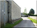
The Ebenezer chapel from Grove Lane
The side of the chapel from the lane. By the drainpipe is an old benchmark - see Image
Image: © Neil Owen
Taken: 29 Apr 2019
0.06 miles
4
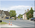
2009 : B4039 at Yatton Keynell heading north west
Soon to pass the Castle Combe Circuit, followed by Upper Castle Combe. then on to Acton Turville.
The road ahead is the minor road going north to Grittleton.
Image: © Maurice Pullin
Taken: 10 May 2009
0.06 miles
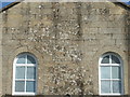
6
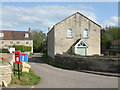
Ebenezer Chapel, Yatton Keynell
The village was inspired to build a chapel in 1835 and it remains in use to this day.
Image: © Neil Owen
Taken: 29 Apr 2019
0.06 miles
7
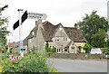
Yatton Keynell
Fork with signposts and an historic Cotswold stone house in the village of Yatton Keynell.
www.yattonkeynell.com
Image: © Colin Smith
Taken: 27 Jul 2019
0.07 miles
8
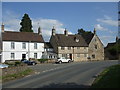
The B4039 in Yatton Keynell
As the main road leaves Yatton Keynell to the north, the B4039 turns to the north west; The Street actually carries on northwards. On one of the houses beside the small conservatory is a benchmark - see Image
Image: © Neil Owen
Taken: 29 Apr 2019
0.07 miles
9
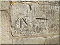
Benchmark on The Street
Yatton Keynell's main road goes through the village. Along the way is a benchmark, and it is listed in the Benchmark Database: https://www.bench-marks.org.uk/bm55719 . See Image] for a wider look of the road and houses.
Image: © Neil Owen
Taken: 29 Apr 2019
0.07 miles
10
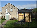
A sign?
The half open notice board seems slightly more relevant with regards to tales of resurrection.
Image: © Neil Owen
Taken: 29 Apr 2019
0.07 miles