
IMAGES TAKEN NEAR TO
Mulberry Close, CHIPPENHAM, SN14 6QU
Introduction
This page details the photographs taken nearby to Mulberry Close, SN14 6QU by members of the Geograph project.
The Geograph project started in 2005 with the aim of publishing, organising and preserving representative images for every square kilometre of Great Britain, Ireland and the Isle of Man.

There are currently over 7.5m images from over14,400 individuals and you can help contribute to the project by visiting https://www.geograph.org.uk
Image Map
Images are licensed for reuse under creativecommons.org/licenses/by-sa/2.0
Notes
- Clicking on the map will re-center to the selected point.
- The higher the marker number, the further away the image location is from the centre of the postcode.
Image Listing (22 Images Found)
Images are licensed for reuse under creativecommons.org/licenses/by-sa/2.0
Image
Details
Distance
1
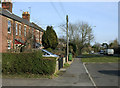
2010 : Rank of older houses adjoining the A420
Just past the roundabout on the bypass as you enter Chippenham.
Image: © Maurice Pullin
Taken: 16 Mar 2010
0.13 miles
2
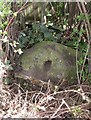
Old Milestone by the A420, Bristol Road, Chippenham
Metal plate attached to stone post by the A420, in parish of CHIPPENHAM WITHOUT (NORTH WILTSHIRE District), Bristol Road, 105m North West of junction with Old Hardenhuish Lane and tollhouse, deep in hedge between path and wooden fence, on North side of road. Marshfield iron plate, erected by the Chippenham turnpike trust in the 19th century.
Inscription reads:-
8 MILES
TO
(MARSHFIELD)
(1 MILE)
(TO)
(CHIPPENHAM)
Grade II listed. List Entry Number: 1022902
https://historicengland.org.uk/listing/the-list/list-entry/1022902
Milestone Society National ID: WI_CPMF01.
Image: © A Rosevear
Taken: 23 Sep 2003
0.14 miles
3
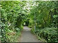
Link path off Stainers Way
This short, straight section of footpath connects the housing estate to a longer foot and cycle path that runs for 1.3km alongside the Hardenhuish Brook from the ring road to Bristol Road on the outskirts of the town centre.
Image: © Stephen Craven
Taken: 13 Jul 2022
0.14 miles
4
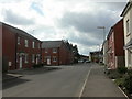
Chippenham, Middlefield Road
In the foreground, modern housing; older, farther South.
Image: © Mike Faherty
Taken: 7 Apr 2010
0.15 miles
5
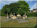
The stone circle on Redwing Avenue
I wondered whether this structure in a modern housing estate might be formed from parts of some historic house that once stood on the site, but a local person explained that the show houses for the estate were close by, and this was part of the developer's promotional work.
Image: © Stephen Craven
Taken: 15 Jul 2022
0.15 miles
6
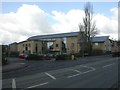
Chippenham, Hathaway Medical Centre
On Marshfield Road, at the junction with Middlefield Road. http://www.hathawaysurgery.co.uk/asp/mContent.asp?pID=389
Image: © Mike Faherty
Taken: 7 Apr 2010
0.15 miles
8
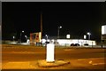
Brand new Lidl store on Hungerdown Lane, Chippenham
It opened on February the 14th 2019. The map shows a school occupied the site previously.
Image: © David Howard
Taken: 1 Jun 2019
0.18 miles
9
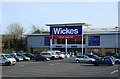
2010 : Wickes DIY store, Chippenham
Off the A420 to the north of a business park west of Chippenham.
Image: © Maurice Pullin
Taken: 16 Mar 2010
0.19 miles
10
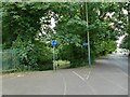
Cycleway off Hardenhuish Lane
Part of a longer foot and cycle path that runs for 1.3km alongside the Hardenhuish Brook from the ring road to Bristol Road on the outskirts of the town centre.
Image: © Stephen Craven
Taken: 13 Jul 2022
0.20 miles