
IMAGES TAKEN NEAR TO
Newtown, CHIPPENHAM, SN14 6EN
Introduction
This page details the photographs taken nearby to Newtown, SN14 6EN by members of the Geograph project.
The Geograph project started in 2005 with the aim of publishing, organising and preserving representative images for every square kilometre of Great Britain, Ireland and the Isle of Man.

There are currently over 7.5m images from over14,400 individuals and you can help contribute to the project by visiting https://www.geograph.org.uk
Image Map
Images are licensed for reuse under creativecommons.org/licenses/by-sa/2.0
Notes
- Clicking on the map will re-center to the selected point.
- The higher the marker number, the further away the image location is from the centre of the postcode.
Image Listing (21 Images Found)
Images are licensed for reuse under creativecommons.org/licenses/by-sa/2.0
Image
Details
Distance
1
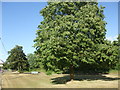
At the end of The Street
A small open space, large trees and a memorial bench to mark the north east end of Hullavington.
Image: © Neil Owen
Taken: 5 Jun 2020
0.10 miles

6
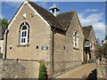
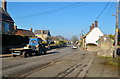
Hullanvington's old school
The former Hullavington County Primary Infants School in The Street. The Junior school was set up further along the road and is now the only educational site.
Image: © Neil Owen
Taken: 5 Jun 2020
0.15 miles
7

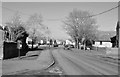
Hullavington village hall
This modern and well-used facility was built and opened on September 1st, 2006. It stands on the site of the previous hall, a wooden building dating from 1971 that was totally destroyed by a fire two years earlier.
Image: © Neil Owen
Taken: 5 Jun 2020
0.17 miles
8
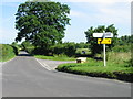
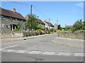
Road junction on a lane to the NE of Hullavington
Image: © Nick Smith
Taken: 1 Jul 2008
0.17 miles
9
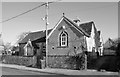
The Old School, The Street, Hullavington, Wiltshire 2015
Image: © Ray Bird
Taken: 9 Feb 2015
0.18 miles
10
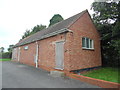
Hullavington Telephone Exchange
Situated north east of the village, this building has the code SSHUL. It provides telephone and broadband services to 794 residential and 32 non-residential premises in Hullavington plus Lower Stanton St Quintin, Norton, Stanton St Quintin and the surrounding rural area. The numbering ranges of this TE are (01666) 837xxx, 838xxx, the (01666) referring to the Malmesbury group of nine TEs, and its postcode is SN14 6ES.
Image: © David Hillas
Taken: 16 Aug 2019
0.18 miles