1
A view down Little London, Swindon
Little London is now an unremarkable little backstreet just east of Albert Street
Image but in its day the Albert Street/Little London area was a red light district and the haunt of the 'lowest labourers' where it was said that 'almost any vice might be witnessed or indulged in'. Source: 'Swindon. An Illustrated History' Mark Child, Breedon Books, 2002. The tall chimney in the background marks the location of BMW's MINI panel plant at SU167863, 2.77 kilometres north.
Image: © Brian Robert Marshall
Taken: 16 Dec 2007
0.01 miles
2
Mission over
A forlorn and derelict appearing building on Church Road. Old maps indicate it was a former mission hall.
Image: © Neil Owen
Taken: 10 Jun 2014
0.01 miles
3
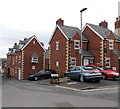
Little London, Swindon
Recently-built housing in the Old Town area of Swindon.
Image: © Jaggery
Taken: 14 Apr 2013
0.01 miles
4
Pope Bros office and yard in Swindon
Building contractors' premises viewed across Cricklade Street looking towards the corner of Church Lane.
Image: © Jaggery
Taken: 14 Apr 2013
0.02 miles
5
Church Road is closed
The barriers look fairly temporary but the double yellow lines imply a more permanent solution.
Image: © Neil Owen
Taken: 10 Jun 2014
0.02 miles
6
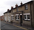
The Roaring Donkey, Old Town, Swindon
Located in Albert Street. The pub sign seen in a view http://www.geograph.org.uk/photo/634403 taken in 2006
has been replaced by a text sign in this April 2013 view.
Image: © Jaggery
Taken: 14 Apr 2013
0.03 miles
7
Longs Lounge, Swindon
On the corner of Union Row and Belle Vue Road, Longs Lounge is part of Longs Bar, available for private hire.
Image: © Jaggery
Taken: 14 Apr 2013
0.03 miles
8
Union Row, Old Town, Swindon
Row of stone-built houses in Swindon's Old Town. Behind them to the left is the back of the Swindon Advertiser building.
Image: © Vieve Forward
Taken: 25 Dec 2012
0.04 miles
9
Plaque, Anderson's Hostel, Cricklade Street, Swindon
The plaque is to be found on the western elevation of a small row of dwellings now rather more prosaically addressed as 27-30 Cricklade Street. The term 'second poor' apparently refers to folk who were parishioners and who were not receiving relief from the parish. http://archiver.rootsweb.ancestry.com/th/read/Bristol_and_Somerset/2003-05/1052087753 The building to which the plaque is attached is shown here http://www.geograph.org.uk/photo/1113394
Image: © Brian Robert Marshall
Taken: 9 Jan 2009
0.04 miles
10
Anderson's Hostel, Cricklade Street, Swindon
The building dates to 1877 and was built as a hostel for the 'second poor'. There is more information here http://www.geograph.org.uk/photo/1113380 In front of the dwellings is the churchyard of Christ Church.
Image: © Brian Robert Marshall
Taken: 9 Jan 2009
0.04 miles


