
IMAGES TAKEN NEAR TO
Kingsdown, CORSHAM, SN13 8BH
Introduction
This page details the photographs taken nearby to SN13 8BH by members of the Geograph project.
The Geograph project started in 2005 with the aim of publishing, organising and preserving representative images for every square kilometre of Great Britain, Ireland and the Isle of Man.

There are currently over 7.5m images from over14,400 individuals and you can help contribute to the project by visiting https://www.geograph.org.uk
Image Map
Images are licensed for reuse under creativecommons.org/licenses/by-sa/2.0
Notes
- Clicking on the map will re-center to the selected point.
- The higher the marker number, the further away the image location is from the centre of the postcode.
Image Listing (8 Images Found)
Images are licensed for reuse under creativecommons.org/licenses/by-sa/2.0
Image
Details
Distance
1
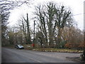
Lower Kingsdown Road
A view looking west down the hill from Kingsdown to Bathampton, at the junction with Lower Kingsdown Road (right)
Image: © Phil Williams
Taken: 15 Mar 2006
0.06 miles
2
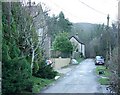
2008 : Lower Kingsdown Road
The post box appearing in Image] is visible where Lower Kingsdown Road joins the road from Bathford.
Image: © Maurice Pullin
Taken: 12 Jan 2008
0.10 miles
3
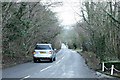
2008 : Road to Bathford, Kingsdown
Looking along the road to Bathford from a spot near The Swan at Kingsdown.
Image: © Maurice Pullin
Taken: 12 Jan 2008
0.13 miles
4
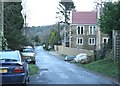
2008 : Lower Kingsdown Road (2)
Looking east near the west end of Lower Kingsdown Road where it approaches the road from Bathford.
Image: © Maurice Pullin
Taken: 12 Jan 2008
0.14 miles
5
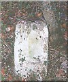
Old Milestone, High Street, Bathford Hill
The milestone is located on the wide bank beside trees on the south side of the road. Parish of Bathford (Bath and North East Somerset District). Stone post (attached metal plate missing), Bath incised iron plate design, erected by the Bath turnpike trust in the 19th century.
The original metal plate is missing in this image. Its date is not known but it was taken before a replacement plate was fitted by Bath and North East Somerset council in 2007. See https://www.geograph.org.uk/photo/7050421
Inscription read:-
To / BATH / 4
Grade II Listed, List Entry Number: 1115291
https://historicengland.org.uk/listing/the-list/list-entry/1115291
Milestone Society National ID: SO_BAKD04
Image: © JR Dowding
Taken: 1 Jan 1900
0.19 miles
6
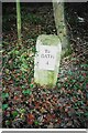
Old Milestone, High Street, Bathford Hill
The milestone is located on the wide bank beside trees on the south side of the road. Parish of Bathford (Bath and North East Somerset District). Metal plate attached to stone post, Bath incised iron plate Erected by the Bath turnpike trust in the 19th century.
The replacement plate was fitted by Bath and North East Somerset council in 2007.
Inscription reads:-
To / BATH / 4
Grade II Listed, List Entry Number: 1115291
https://historicengland.org.uk/listing/the-list/list-entry/1115291
Milestone Society National ID: SO_BAKD04
Image: © Janet Dowding
Taken: 30 Dec 2007
0.19 miles
7
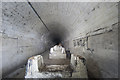
Upper reaches of Farleigh Down tunnel
Location is approximate, but certainly within this grid square. The inclined tunnel is over a mile in length and was used to transport ammunition arriving via the railway to the north with the underground storage depot to the south.
Image: © Noel Jenkins
Taken: 15 May 2010
0.23 miles
8
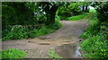
Ashley Brook Ford
This ford is found on the byway beyond Bannerdown View Farm.
Image: © John Walton
Taken: 21 May 2016
0.23 miles