1
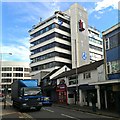
Fleming Way in Swindon - under re-development
Fleming one, once a dual-carriage and central point for buses, has been closed and the road removed as part of a wide-scale redevelopment around the town centre.
Image: © Gareth James
Taken: 26 Aug 2023
0.01 miles
2
Fleet Street, Swindon
There is much architectural diversity in this part of central Swindon, which is mainly commercial in character. The local authority have devised some novel car parking arrangements for the many office workers who flood into the area during the week.
Image: © Brian Robert Marshall
Taken: 15 Mar 2014
0.02 miles
3
Fleming Way
A town centre dual carriageway which incorporates the bus station.
Image: © Bill Boaden
Taken: 22 Jul 2016
0.02 miles
4
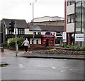
Super Pizza in Swindon
The red-fronted takeaway is at 39 Fleet Street.
Image: © Jaggery
Taken: 3 Sep 2017
0.03 miles
5
Cars on the building, Fleet Street, Swindon
Swindon is quite well-known for its surreal traffic systems.
Image: © Robert Eva
Taken: 6 Dec 2017
0.03 miles
6
Buses on Fleming Way, Swindon ? 1972
This view shows Fleming Way in its first phase of development. The area to the right, where the buildings of the then bus station https://www.geograph.org.uk/photo/3831984 can be seen, has been completely redeveloped as the Tricentre https://www.geograph.org.uk/photo/881825 whilst the terraced buildings in the background have been replaced by Milford House https://www.geograph.org.uk/photo/881823 .
The two double-deck buses are the typical Daimler CVG6/Park Royal combination that Swindon Corporation Transport favoured in the 40s, 50s and 60s, dating from 1957 (107) and 1961 (117) respectively. No.107 displays the lighter shade of blue that the undertaking had recently adopted.
This is one of a series of views featuring buses in the 60s, 70s, and 80s.
http://www.geograph.org.uk/search.php?i=2114547&displayclass=slide
Image: © Alan Murray-Rust
Taken: 9 Jun 1972
0.03 miles
7
Construction - and no doubt de-construction, in Swindon town centre
Image: © Ruth Sharville
Taken: 14 Jul 2022
0.03 miles
8
Focal Point
Office block in Swindon.
Image: © JThomas
Taken: 13 Jul 2019
0.03 miles
9
Fleming Way, Swindon 2008
Taken from a close approximation to this image from 1967 by Gordon Hatton http://www.geograph.org.uk/photo/862450 everything on the far side of the road in that image has gone. The cleared site that in 1967 was used for car parking is now occupied by Zurich Insurance. The old buildings in the older image have also been cleared and replaced by new office blocks and some new housing. A view along Milford Street as it is now can be seen here http://www.geograph.org.uk/photo/881823
Image: © Brian Robert Marshall
Taken: 13 Jul 2008
0.03 miles
10
Fleming Way, 1967
The newly opened Fleming Way dual carriageway was built largely along the line of the Wilts & Berks and North Wilts canals. The open space beyond eventually became the bus station, whilst in the background is Milford Street with the three storey premises of Duck, Son and Pinker, which was the premier music shop in the town. The milk float in the foreground appears slightly blurred, presumably due to its excessive speed.
Image: © Gordon Hatton
Taken: Unknown
0.04 miles


