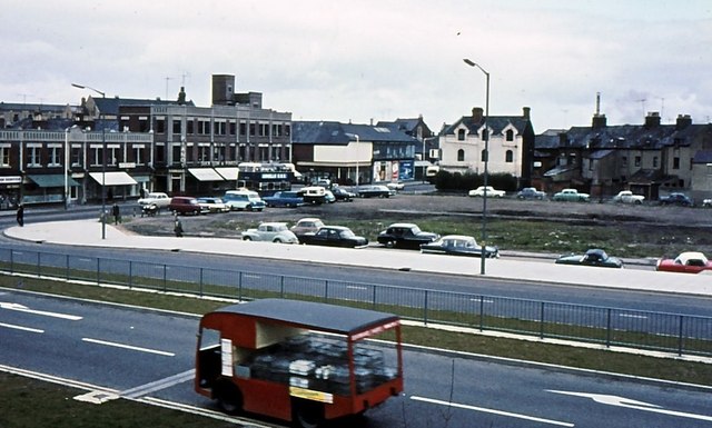
Fleming Way, 1967
Introduction
The photograph on this page of Fleming Way, 1967 by Gordon Hatton as part of the Geograph project.
The Geograph project started in 2005 with the aim of publishing, organising and preserving representative images for every square kilometre of Great Britain, Ireland and the Isle of Man.
There are currently over 7.5m images from over 14,400 individuals and you can help contribute to the project by visiting https://www.geograph.org.uk

Image: © Gordon Hatton Taken: Unknown
The newly opened Fleming Way dual carriageway was built largely along the line of the Wilts & Berks and North Wilts canals. The open space beyond eventually became the bus station, whilst in the background is Milford Street with the three storey premises of Duck, Son and Pinker, which was the premier music shop in the town. The milk float in the foreground appears slightly blurred, presumably due to its excessive speed.

