
IMAGES TAKEN NEAR TO
Beckhampton Street, SWINDON, SN1 2JY
Introduction
This page details the photographs taken nearby to Beckhampton Street, SN1 2JY by members of the Geograph project.
The Geograph project started in 2005 with the aim of publishing, organising and preserving representative images for every square kilometre of Great Britain, Ireland and the Isle of Man.

There are currently over 7.5m images from over14,400 individuals and you can help contribute to the project by visiting https://www.geograph.org.uk
Image Map
Images are licensed for reuse under creativecommons.org/licenses/by-sa/2.0
Notes
- Clicking on the map will re-center to the selected point.
- The higher the marker number, the further away the image location is from the centre of the postcode.
Image Listing (225 Images Found)
Images are licensed for reuse under creativecommons.org/licenses/by-sa/2.0
Image
Details
Distance
1
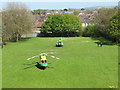
Spring Gardens
Viewed from the top of Spring Gardens multistorey carpark, the Wiltshire Air Ambulance and the Great Western Air Ambulance in Spring Gardens while paramedics attend a nearby emergency.
Image: © David Tyers
Taken: 4 May 2016
0.03 miles
2
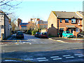
Newcastle Street and its junction with Plymouth Street, Swindon
Newcastle Street passes across the image from left to right. The viewpoint is in Plymouth Street. One purpose of the section of Plymouth Street leading away from the viewpoint was to provide access to the large Garrards factory that once stood at the right, and which can be seen in this historic image from P L Chadwick Image The blue-coloured building is a retail outlet built in the early 1990s.
Image: © Brian Robert Marshall
Taken: 20 Dec 2009
0.05 miles
3
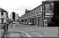
Garrard Factory, Newcastle Street & Plymouth Street
As well as having its main frontages to Newcastle Street & Fleming Way, the factory also partly fronted the extension of Plymouth Street. The factory gates were also here, and can be seen in the distance ahead. When the factory was in operation, it usually worked night and day, and the thump of the presses could be heard in nearby houses. The factory suffered a major fire in about 1958, Swindon's worst to date, but the factory was rebuilt, and continued operation for another twenty plus years. Image
Some multi-storey buildings can be seen in the distance. They were built as offices for various organisations on land between Princes Street & Spring Gardens. Originally Princes Street had two-storey terraced houses on both sides.
Image: © P L Chadwick
Taken: 18 Jan 1983
0.06 miles
4
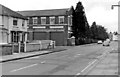
Garrard Factory, Newcastle Street
This was the main Garrard factory and had long frontages to both Newcastle Street and Fleming Way. The Newcastle Street frontage, as can be seen in this view, was partially hidden by the large trees. The factory mainly made gramophone record decks, for which it was renowned, but during the Second World War it made a lot of clocks. Garrard was taken over by a Brazilian company in 1979, and continued to decline, unable to compete with Japanese competition. The factory was demolished in the 1990's, having ceased manufacture about 1982. Along the frontage to Newcastle Street, new housing has been built. Most of the remainder of the site became a B & Q store and a branch of Halfords. B & Q have gone elsewhere and been replaced by a branch of The Range.
Image: © P L Chadwick
Taken: 18 Jan 1983
0.07 miles
5
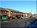
New houses, Newcastle Street, Swindon
These houses were constructed in the 1990s as part of the redevelopment of the site once occupied by the large record player factory Garrards. The houses are situated on the area marked by the row of trees in this historic image from P L Chadwick Image from 1983.
Image: © Brian Robert Marshall
Taken: 20 Dec 2009
0.08 miles
6
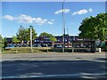
The Range, Fleming Way, Swindon
Part of a retail park on the site of a former brickworks.
Image: © Stephen Craven
Taken: 14 Jul 2022
0.08 miles
7
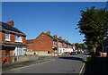
York Road, Swindon
Part of a neighbourhood of similar streets named after towns.
Image: © Des Blenkinsopp
Taken: 10 Oct 2022
0.09 miles
8

Rainbow over central Swindon
The viewpoint is the car park of a retail park containing branches of The Range and Halfords. The site was once occupied by the Garrards gramophone company Image The houses in the background are in Newcastle Street Image This image was obtained on my cellphone after a shopping trip.
Image: © Brian Robert Marshall
Taken: 23 Sep 2010
0.09 miles
9
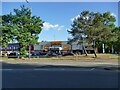
Halfords, Fleming Way, Swindon
Part of a retail park on the site of a former brickworks.
Image: © Stephen Craven
Taken: 14 Jul 2022
0.09 miles
10

Civic Offices, Swindon
Swindon's current town hall, in Euclid street.
Image: © Roger Cornfoot
Taken: 13 Mar 2007
0.10 miles