
IMAGES TAKEN NEAR TO
Southampton Street, SWINDON, SN1 2JT
Introduction
This page details the photographs taken nearby to Southampton Street, SN1 2JT by members of the Geograph project.
The Geograph project started in 2005 with the aim of publishing, organising and preserving representative images for every square kilometre of Great Britain, Ireland and the Isle of Man.

There are currently over 7.5m images from over14,400 individuals and you can help contribute to the project by visiting https://www.geograph.org.uk
Image Map
Images are licensed for reuse under creativecommons.org/licenses/by-sa/2.0
Notes
- Clicking on the map will re-center to the selected point.
- The higher the marker number, the further away the image location is from the centre of the postcode.
Image Listing (140 Images Found)
Images are licensed for reuse under creativecommons.org/licenses/by-sa/2.0
Image
Details
Distance
1
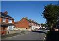
York Road, Swindon
Part of a neighbourhood of similar streets named after towns.
Image: © Des Blenkinsopp
Taken: 10 Oct 2022
0.07 miles
3
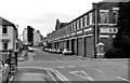
Garrard Factory, Newcastle Street & Plymouth Street
As well as having its main frontages to Newcastle Street & Fleming Way, the factory also partly fronted the extension of Plymouth Street. The factory gates were also here, and can be seen in the distance ahead. When the factory was in operation, it usually worked night and day, and the thump of the presses could be heard in nearby houses. The factory suffered a major fire in about 1958, Swindon's worst to date, but the factory was rebuilt, and continued operation for another twenty plus years. Image
Some multi-storey buildings can be seen in the distance. They were built as offices for various organisations on land between Princes Street & Spring Gardens. Originally Princes Street had two-storey terraced houses on both sides.
Image: © P L Chadwick
Taken: 18 Jan 1983
0.09 miles
4
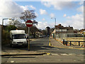
Plymouth Street at its junction with Drove Road, Swindon
Plymouth Street is part of what used to be known as the New Town part of Swindon. Although New Town still appears on some maps hardly anyone uses the name in contrast to the Old Town area, south of here and on a hill where, perhaps because it has some cachet, the term is commonly heard. Just visible to the right is the recently cleared site seen in this image Image For a view along Plymouth Street see this image Image At the left is a 2006-registered Ford Transit operated by BT. The Transit is perhaps the most ubiquitous 'white van' to be seen on Britain's road. It first appeared in the mid 1960s as a replacement for the Ford Thames. I haven't checked but I believe that the Transits are built in Slough or Southampton or perhaps both.
Image: © Brian Robert Marshall
Taken: 26 Feb 2010
0.09 miles
5
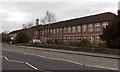
Drove Primary School, Swindon
The large school on the west side of Drove Road has about 550 pupils enrolled, ages 3-11.
Image: © Jaggery
Taken: 14 Apr 2013
0.10 miles
6
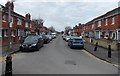
York Road, Swindon
Viewed from the edge of Queen's Park, this is the southern end of York Road which extends for 500 metres to Fleming Way.
Image: © Jaggery
Taken: 14 Apr 2013
0.10 miles
7
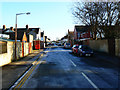
Plymouth Street, Swindon
This street runs in a straight line from Newcastle Street to Drove Road, just visible in the distance about 330 metres away. Swindon escaped most of the snow that affected the eastern parts of the UK in the last day or so - being that bit further away from the Urals probably helped in that regard. Nevertheless there was a very light snow shower overnight the legacy of which is ice on the minor roads, some of which can be seen here. The property at the left marked by the orange wheelie-bin is the York Fish Bar which sells the best fish and chips anywhere in the world. The owner, an extremely affable Hong Kong expatriate, is pleased to display a complimentary letter he received not long ago from Hazel Blears MP, the small but perfectly formed member of parliament for Salford and a former Cabinet minister.
Image: © Brian Robert Marshall
Taken: 20 Dec 2009
0.10 miles
8
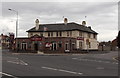
The Merlin, Swindon
Pub on the corner of Southampton Street and Groundwell Road, viewed across the B4289 Drove Road.
Image: © Jaggery
Taken: 14 Apr 2013
0.10 miles
9
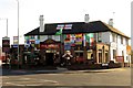
The Merlin on Drove Road
The Merlin was formerly a Morrells pub called the Oxford.
Image: © Steve Daniels
Taken: 25 Jun 2014
0.10 miles
10
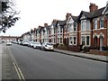
Euclid Street
One of the many streets of terraced houses in the area. Seen from the junction with Leicester Street.
Image: © Michael Dibb
Taken: 28 Mar 2017
0.10 miles