
IMAGES TAKEN NEAR TO
Fleming Way, SWINDON, SN1 1TN
Introduction
This page details the photographs taken nearby to Fleming Way, SN1 1TN by members of the Geograph project.
The Geograph project started in 2005 with the aim of publishing, organising and preserving representative images for every square kilometre of Great Britain, Ireland and the Isle of Man.

There are currently over 7.5m images from over14,400 individuals and you can help contribute to the project by visiting https://www.geograph.org.uk
Image Map
Images are licensed for reuse under creativecommons.org/licenses/by-sa/2.0
Notes
- Clicking on the map will re-center to the selected point.
- The higher the marker number, the further away the image location is from the centre of the postcode.
Image Listing (574 Images Found)
Images are licensed for reuse under creativecommons.org/licenses/by-sa/2.0
Image
Details
Distance
1
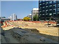
Excavations for Swindon's Bus Boulevard
This stretch of Fleming Way is being converted to a bus interchange to improve connectivity between the train station and the town centre. It is part of a major investment in the town centre and is due for completion in 2024. More here https://www.swindon.gov.uk/info/20136/transport_strategy/1089/fleming_way_improvements
Image: © Brian Robert Marshall
Taken: 9 Jun 2023
0.02 miles
3
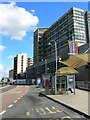
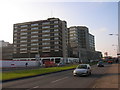
Fleming Way, Swindon 2008
Taken from a close approximation (slightly different to avoid the frame being filled with bus shelters) to this image from 1967 by Gordon Hatton http://www.geograph.org.uk/photo/862455 the lower part of the building on the right is occupied by Debenhams, the well-known chain store. The office above, under construction in 1967, is, as far as I know, still occupied by Zurich Insurance, formerly Allied Dunbar which grew out of Hambro Life. Beyond that, the high-rise is an hotel. The traditional terraced housing visible in the background of the older image, in Princes Street, was replaced in the 1970s by an office occupied by the Benefits Agency (DHSS in old money).
Image: © Brian Robert Marshall
Taken: 13 Jul 2008
0.02 miles
4
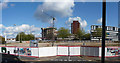
Swindon : Empty Space & Construction
An empty site with construction going on behind it. This was taken from the multi-storey car park.
Image: © Lewis Clarke
Taken: 22 Oct 2008
0.03 miles
6
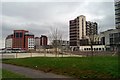
Hotels, Swindon
Jurys Inn hotel is the red-brick building at the far left. At the right is the somewhat older Menzies Swindon Hotel. Just to the left of that is a Travelodge in what was once Nationwide Building Society's HQ. Just behind Jurys Inn is a building shown on the maps as 'Government Offices'. The foreground shows a temporary area of open space with newly planted grass and trees. Taken on a typical rather dull February day.
Image: © Brian Robert Marshall
Taken: 21 Feb 2012
0.04 miles
7
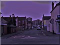
Central Swindon from County Road
Along Bathurst Road.
Image: © Chris Brown
Taken: 21 Mar 2018
0.04 miles
8
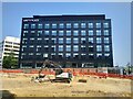
Unity Place, Fleming Way, Swindon
Unity Place is yet another building in Swindon occupied by Zurich Insurance. This one is the most recent. The white building at the left is also occupied by Zurich.
Image: © Brian Robert Marshall
Taken: 9 Jun 2023
0.04 miles
9
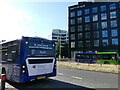
"Lonely bus desperately seeking new driver"
There were a lot of vacancies in many sectors, including hospitality and transport, at the time this photo was taken. Advertising, as a consequence, needed to be original and catchy! See Image
Image: © Ruth Sharville
Taken: 14 Jul 2022
0.04 miles
10
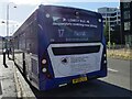
"Lonely Bus" - close up of recruitment advertisement on a bus in Swindon
Image: © Ruth Sharville
Taken: 14 Jul 2022
0.04 miles