
Fleming Way, Swindon 2008
Introduction
The photograph on this page of Fleming Way, Swindon 2008 by Brian Robert Marshall as part of the Geograph project.
The Geograph project started in 2005 with the aim of publishing, organising and preserving representative images for every square kilometre of Great Britain, Ireland and the Isle of Man.

There are currently over 7.5m images from over 14,400 individuals and you can help contribute to the project by visiting https://www.geograph.org.uk
Fleming Way, Swindon 2008
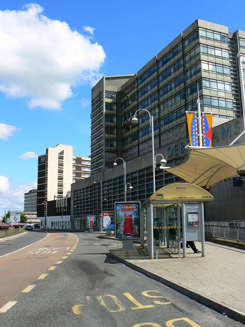
Image: © Brian Robert Marshall Taken: 13 Jul 2008
Taken from a close approximation (slightly different to avoid the frame being filled with bus shelters) to this image from 1967 by Gordon Hatton http://www.geograph.org.uk/photo/862455 the lower part of the building on the right is occupied by Debenhams, the well-known chain store. The office above, under construction in 1967, is, as far as I know, still occupied by Zurich Insurance, formerly Allied Dunbar which grew out of Hambro Life. Beyond that, the high-rise is an hotel. The traditional terraced housing visible in the background of the older image, in Princes Street, was replaced in the 1970s by an office occupied by the Benefits Agency (DHSS in old money).
Images are licensed for reuse under creativecommons.org/licenses/by-sa/2.0
Image Location

Latitude
51.562417
Longitude
-1.782698