
IMAGES TAKEN NEAR TO
Spirthill, CALNE, SN11 9HP
Introduction
This page details the photographs taken nearby to SN11 9HP by members of the Geograph project.
The Geograph project started in 2005 with the aim of publishing, organising and preserving representative images for every square kilometre of Great Britain, Ireland and the Isle of Man.

There are currently over 7.5m images from over14,400 individuals and you can help contribute to the project by visiting https://www.geograph.org.uk
Image Map
Images are licensed for reuse under creativecommons.org/licenses/by-sa/2.0
Notes
- Clicking on the map will re-center to the selected point.
- The higher the marker number, the further away the image location is from the centre of the postcode.
Image Listing (10 Images Found)
Images are licensed for reuse under creativecommons.org/licenses/by-sa/2.0
Image
Details
Distance
1
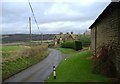
Spirthill
A cluster of cottages at the northestern end of Spirthill.
Image: © Roger Cornfoot
Taken: 12 Jan 2007
0.06 miles
2
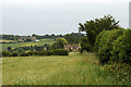
2011 : Mowing Grass near Siderow Farm
Looking along a field edge, Spirthill House in the distance.
Image: © Maurice Pullin
Taken: 28 Jun 2011
0.11 miles
3
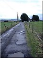
Leekshedge farm
An isolated, windswept modern farmhouse.
Image: © Roger Cornfoot
Taken: 12 Jan 2007
0.14 miles
4
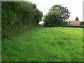
Footpath through a meadow towards Spirthill
The country road that wends its way through the hamlet of Spirthill is marked by the building to the right of the image. From here it was possible to see the tailplanes of Hercules aircraft taxiing at RAF Lyneham a couple of kilometres north of here. The footpath can just be discerned in the lush grass.
Image: © Brian Robert Marshall
Taken: 27 Jul 2008
0.14 miles
5
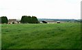
Meadow, Spirthill
The field in the foreground is lush meadow grass. The farm beyond is Leekshedge Farm just east of the 2° west meridian in the next myriad over. The viewpoint is a footpath through the meadow.
Image: © Brian Robert Marshall
Taken: 27 Jul 2008
0.15 miles

7
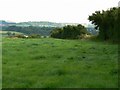
Footpath through a meadow, Spirthill
The footpath is to the right of the image a few metres to the left of the hedge. The viewpoint is about 110 metres west of the 2° west meridian.
Image: © Brian Robert Marshall
Taken: 27 Jul 2008
0.15 miles
8
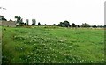
Farmland near Spirthill
The view shows a lush meadow. The viewpoint is from a footpath crossing the meadow. The building at the left is part of Leekshedge Farm.
Image: © Brian Robert Marshall
Taken: 27 Jul 2008
0.17 miles
9
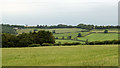
2011 : Mowing grass near Siderow Farm
Not far from Spirthill.
A footpath crosses the field heading toward Lyneham Airfield, a few of its hangars and a water tower can be seen. The valley between carries Cade Burns which flows west and later joins the River Avon.
Image: © Maurice Pullin
Taken: 28 Jun 2011
0.21 miles
10
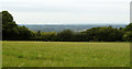
2011 : Grass ready for mowing near Siderow Farm
A good hay crop if the farmer catches it before the rain otherwise it will have to go for silage, cattle don't mind, they like both.
The view beyond is over South Gloucestershire with hills on the other side of the Bristol Channel in the distance.
Image: © Maurice Pullin
Taken: 28 Jun 2011
0.24 miles